AKA: none
Other ID: A-8-03-HW
Status: Completed
Organization(s): USGS, Pacific Coastal and Marine Science Center
Funding Program(s): Geologic Processes on Coral Reefs (MU117)
Principal Investigator(s): Ann Gibbs, Eric Grossman
Affiliate Investigator(s):
Information Specialist(s): Ann Gibbs, Joshua Logan
Data Type(s): Environmental Data: CTD, Imagery: Photo, Imagery: Video, Location-Elevation: Navigation, Sampling: Chemistry
Scientific Purpose/Goals: Map underwater resources (corals, bottom habitat) of Kaloko-Honokohau National Park
Vehicle(s):
Start Port/Location: Honokohau Harbor, Hawaii
End Port/Location: Honokohau Harbor, Hawaii
Start Date: 2003-12-11
End Date: 2003-12-17
Equipment Used: underwatertelevision, CTD, underwatercamera, navigation, waterbucket
Information to be Derived: Benthic habitat, water temperature, and salinity
Summary of Activity and Data Gathered: Collect geographically referenced underwater video and CTD data in Kaloko-Honokohau National park for the primary purpose of documenting the offshore resources including coral reefs and other benthic habitats
Staff: Susan Cochran, Ann Gibbs, Eric Grossman, Joshua Logan
Affiliate Staff:
Notes: N/A
Staff information imported from InfoBank
Ann Gibbs (USGS) - Survey planning and data aquisition
Eric Grossman (USGS) - Survey planning and data aquisition
Susie Cochran (Data aquisition, USGS) - Marquez
Josh Logan (USGS) - Data acquisition/navigation
Location:
Hawaii
| Boundaries | |||
|---|---|---|---|
| North: 19.69852 | South: 19.66505 | West: -156.05 | East: -156.02128 |
Platform(s):
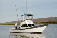
 Alyce C |
Knee, K.L., Street, J.H, Grossman, E.E., Boehm, A.B. and Paytan, A., 2010, Nutrient inputs to the coastal ocean from submarine groundwater discharge in a groundwater-dominated system: Relation to land use (Kona coast, Hawaii, U.S.A.): Limnology and Oceanography, v. 55 no. 3, pp. 1105–1122, doi: 10.4319/lo.2010.55.3.1105.
FAN A803HW has data viewable in the CMGP Video and Photograph Portal. View the data in this application here. See the instructions for working with this application.
| Survey Equipment | Survey Info | Data Type(s) | Data Collected |
|---|---|---|---|
| underwatertelevision | --- | Video | underwater television Global positioning system (GPS) data a-8-03-hw.060_video (nav for video but not 'best file') |
| CTD | --- | Surveys (geochemical) Experiments (geochemical) CTD | ctdmeter |
| underwatercamera | --- | Video Photo | underwater camera analog holdings (DVD tapes) |
| navigation | --- | Navigation | Global positioning system (GPS) data a-8-03-hw.060 Global positioning system (GPS) data a-8-03-hw.061 (Provisional best file) |
| waterbucket | --- | Chemistry | waterbucket |