AKA: none
Other ID: B-04-12-NC
Status: Completed
Organization(s): USGS, Pacific Coastal and Marine Science Center, Oregon State University
Funding Program(s): Coastal and marine earthquake, tsunami, and landslide active margin field studies (ZP00EQV)
Principal Investigator(s): Samuel Johnson
Affiliate Investigator(s):
Information Specialist(s): Jeff Beeson, Samuel Johnson, Ray Sliter
Data Type(s): Electro-Magnetic: Magnetics, Location-Elevation: Navigation, Seismics: Sparker
Scientific Purpose/Goals: Mapping the northern San Andreas Fault Zone
Vehicle(s):
Start Port/Location: Fort Bragg, CA
End Port/Location: Fort Bragg, CA
Start Date: 2012-09-17
End Date: 2012-09-25
Equipment Used: GPS, Mini-sparker, magnetics, Sparker
Information to be Derived: Seismic-reflection profiles; marine magnetic data
Summary of Activity and Data Gathered:
Staff: Jeff Beeson, Samuel Johnson
Affiliate Staff:
Chris Goldfinger - Oregon State Univ.
Notes: Staff information imported from InfoBank
Sam Johnson
Jeff Beeson
Chris Goldfinger - Oregon State Univ.
Non USGS data manager = Chris Goldfinger
Location:
Between Fort Bragg and Cape Mendocino
| Boundaries | |||
|---|---|---|---|
| North: 40.30684 | South: 39.35035 | West: -124.478 | East: -123.78899 |
Platform(s):
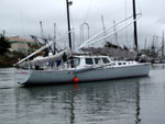 Derek M. Baylis |
Beeson, J.W., and Johnson, S.Y., 2019, Offshore shallow structure and sediment distribution, Punta Gorda to Point Arena, northern California: U.S. Geological Survey Open-File Report 2019-1072, https://doi.org/10.3133/ofr20191072.
Beeson, J.W., Johnson, S.Y., and Cochran, S.A., 2019, California State Waters Map Series Data Catalog--Punta Gorda to Point Arena Region, California: U.S. Geological Survey data release, https://doi.org/10.5066/P9PNNI9H.
Beeson, J.W., Johnson, S.Y., Goldfinger, C., and Hartwell, S.R., 2016, Marine Geophysical Data - Point Arena to Cape Mendocino: U.S. Geological Survey data release.
| Survey Equipment | Survey Info | Data Type(s) | Data Collected |
|---|---|---|---|
| GPS | --- | Navigation | Global positioning system (GPS) data (Provisional best file) Field activity B-04-12-NC: Navigation data for marine geophysical data collected between Punta Gorda and Fort Bragg (northern California) from 09/17/2012 to 09/25/2012 (This dataset includes navigation data for marine geophysical data jointly collected by the U.S. Geological Survey (USGS) and Oregon State University in 2012, between Punta Gorda and Fort Bragg in northern California.) |
| Mini-sparker | --- | Sparker | Seismic FFID/Shot/CDP data (Provisional best file) Field activity B-04-12-NC: Swell-filtered, high-resolution seismic-reflection data collected between Punta Gorda and Fort Bragg (northern California) from 09/17/2012 to 09/25/2012 (Published in Sciencebase; U.S. Geological Survey data release, DOI 10.5066/F7GT5K8R) |
| magnetics | --- | Magnetics | Field activity B-04-12-NC: Magnetic-field level data collected between Punta Gorda and Fort Bragg (northern California) from 09/17/2012 to 09/25/2012 (Published in Sciencebase; U.S. Geological Survey data release, DOI 10.5066/F7GT5K8R) |
| Sparker | --- | Sparker |
