AKA: none
Other ID: B-1-50-SF,BAY_TOLL_XING_1002
Status: Completed
Organization(s): USGS, Pacific Coastal and Marine Science Center, California Division of Bay Toll Crossings
Funding Program(s):
Principal Investigator(s):
Affiliate Investigator(s):
Information Specialist(s): Paul Carlson, Dennis Mann, Mary McGann
Data Type(s): Sampling: Geology
Scientific Purpose/Goals:
Vehicle(s):
Start Port/Location:
End Port/Location:
Start Date: 1950-01-01
End Date: 1950-01-01
Equipment Used: core
Information to be Derived:
Summary of Activity and Data Gathered:
Staff:
Affiliate Staff:
Notes:
Staff information imported from InfoBank
Unspecified - Chief Scientist
Location:
Richmond San Rafael Bridge
| Boundaries | |||
|---|---|---|---|
| North: 38.11022 | South: 37.50575 | West: -122.702 | East: -121.8306 |
Platform(s):
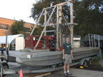 Barge |
| Survey Equipment | Survey Info | Data Type(s) | Data Collected |
|---|---|---|---|
| core | --- | Chemistry Biology Geology | San Francisco Bay Toll Crossing core samples 23, 25, 27 (Analog Materials list) San Francisco Bay Toll Crossing core samples 1, 2, 7, 9, 11, 12, 22, 24, 26, 42, 54, 66, 70, 79, 83, 84, 85, 88, 95, 108, 180, 192, 201, 228, 300, 372, 420, 432, 480, 951, 38728, 08A, 09A, 20-A, 27-1, 453A, 453A, 47-1, 92A, A-8, A26, A45, B-60 (Analog Materials list) |
