AKA: none
Other ID: B-1-70-BS
Status: Completed
Organization(s): USGS, Pacific Coastal and Marine Science Center
Funding Program(s):
Principal Investigator(s): David Scholl
Affiliate Investigator(s):
Information Specialist(s):
Data Type(s): Electro-Magnetic: Magnetics, Location-Elevation: Navigation, Sampling: Geology, Seismics: Sonobuoy, Seismics: Sparker, Sonar: Single Beam
Scientific Purpose/Goals: Seismic study of Aleutian Trench
Vehicle(s):
Start Port/Location:
End Port/Location:
Start Date: 1970-08-02
End Date: 1970-09-24
Equipment Used: bathymetry, sparker, magnetics, dredge, integratednavigation
Information to be Derived:
Summary of Activity and Data Gathered: physical data holdings
Staff:
Affiliate Staff:
Notes: Staff information imported from InfoBank
Dave Scholl (USGS Western Region) - Chief Scientist
Location:
Alaska
| Boundaries | |||
|---|---|---|---|
| North: 62.83995708 | South: 50.25 | West: -179.6229 | East: -159.75999 |
Platform(s):
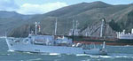 Bartlett |
Cooper, A.K., Bailey, K.A., Marlow, M.S., Scholl, D.W., and Carpenter, C.E., 1976, Preliminary Isopach map of the Bering Sea Basin: U.S. Geological Survey Open-File Report 76-749, 1 p., https://doi.org/10.3133/ofr76749.
Scholl, D.W., Buffington, E.C., and Marlow, M.S., 1976, Aleutian-Bering Sea Region Seismic Reflection Profiles: U.S. Geological Survey Open-File Report 76-74, 1 p., http://pubs.er.usgs.gov/publication/ofr76748.
Steele, W.C., Degnan, C.H., Deeter, G.B., and Riordan, J.A., 1989, Description of marine geophysical data collected by the U.S. Geological Survey and how to obtain it: U.S. Geological Survey Open-File Report 89-167, 26 p., https://pubs.er.usgs.gov/publication/ofr89167.
