AKA: none
Other ID: B-2-70-WO
Status: Completed
Organization(s): USGS, Pacific Coastal and Marine Science Center
Funding Program(s):
Principal Investigator(s): Parke Snavely
Affiliate Investigator(s):
Information Specialist(s):
Data Type(s): Electro-Magnetic: Magnetics, Location-Elevation: Navigation, Seismics: Air Gun / Water Gun, Seismics: Sonobuoy, Seismics: Sparker
Scientific Purpose/Goals:
Vehicle(s):
Start Port/Location:
End Port/Location:
Start Date: 1970-07-15
End Date: 1970-07-20
Equipment Used: sonobuoy, magnetics, LoranC, airgun, transitsatellite, sparker, single channel streamer
Information to be Derived: Seismic reflection profile, magnetics.
Summary of Activity and Data Gathered: 22 lines (A-V).
Staff: Norman MacLeod
Affiliate Staff:
Notes: Staff information imported from InfoBank
Parke Snavely (USGS Western Region) - Chief Scientist
Norman MacLeod (USGS Western Region) - Geologist
Location:
Oregon and Washington coast
| Boundaries | |||
|---|---|---|---|
| North: 50 | South: 41 | West: -131.25 | East: -122.25 |
Platform(s):
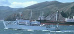 Bartlett |
| Survey Equipment | Survey Info | Data Type(s) | Data Collected |
|---|---|---|---|
| sonobuoy | --- | Sonobuoy | Sonobuoy #1-5 Leg C-E (Analog Materials list) Sonobuoy roll 1-5 (Analog Materials list) |
| magnetics | --- | Magnetics | |
| LoranC | --- | Navigation | |
| airgun | --- | Air Gun / Water Gun | Airgun roll Leg I-O 11, roll 1, and roll line F (Analog Materials list) |
| transitsatellite | --- | Navigation | |
| sparker | --- | Sparker | Sparker Roll 1 120 kj, Line F, H2, H3, H4 1436-20532, 2103-15302, Leg 1 R, and H1-H4 (Analog Materials list) Sparker roll Leg H, roll Leg H2-H4 Govt Pt to Cape Lookout, roll Leg I Cape Lookout to Destruction Island, and roll Leg H2-H3 (Analog Materials list) |
| single channel streamer | --- | Sparker |
