AKA: none
Other ID: B-2-72-BS
Status: Completed
Organization(s): USGS, Pacific Coastal and Marine Science Center
Funding Program(s): Navoceano Deep Ocean Survey (MU201)
Principal Investigator(s): David Scholl
Affiliate Investigator(s):
Information Specialist(s):
Data Type(s): Location-Elevation: Navigation, Environmental Data: Temperature, Seismics: Boomer, Seismics: Sparker, Seismics: Sub Bottom Profiler, Sonar: Single Beam
Scientific Purpose/Goals:
Vehicle(s):
Start Port/Location:
End Port/Location:
Start Date: 1972-08-26
End Date: 1972-09-28
Equipment Used: navigation equipment, subbottomprofiler, sparker, expendablebatthermograph, uniboom, 12khz
Information to be Derived:
Summary of Activity and Data Gathered:
Staff:
Affiliate Staff:
Notes: updated end date from microfilm scan 154093
Part of Cruise 933001, July to October 1972.
Staff information imported from InfoBank
Dave Scholl (USGS Western Region) - Chief Scientist
Location:
Alaska
| Boundaries | |||
|---|---|---|---|
| North: 60.75 | South: 32.25 | West: 145.25 | East: -123.25 |
Platform(s):
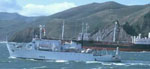 Bartlett |
| Survey Equipment | Survey Info | Data Type(s) | Data Collected |
|---|---|---|---|
| navigation equipment | --- | Navigation | |
| subbottomprofiler | --- | Sub Bottom Profiler | |
| sparker | --- | Sparker | sparker (Analog Materials list) |
| expendablebatthermograph | --- | Temperature | |
| uniboom | --- | Boomer | |
| 12khz | --- | Single Beam |
