AKA: none
Other ID: B-2-76-NP,09030039
Status: Completed
Organization(s): U.S. Naval Oceanographic Office
Funding Program(s): Navoceano Deep Ocean Survey (MU201)
Principal Investigator(s):
Affiliate Investigator(s):
Information Specialist(s):
Data Type(s): Location-Elevation: Navigation, Electro-Magnetic: Magnetics, Seismics: Sparker, Seismics: Sub Bottom Profiler, Environmental Data: Temperature, Environmental Data: Current, Sonar: Single Beam
Scientific Purpose/Goals:
Vehicle(s):
Start Port/Location:
End Port/Location:
Start Date: 1976-04-07
End Date: 1976-04-23
Equipment Used: transitsatellite, magnetics, sparker, 3.5khz, expendablebatthermograph, currentmeter, 12khz
Information to be Derived:
Summary of Activity and Data Gathered: 3.5 khz analog profiles, EDO 240 system, 20 SVSTD stations taken, 17 cores, 163 successful XBTs, 1 current meter array implanted and recovered
Staff:
Affiliate Staff:
Notes: US Naval Oceanographic Office
Staff information imported from InfoBank
Unspecified - Chief Scientist
Location:
Japan
| Boundaries | |||
|---|---|---|---|
| North: 49.99 | South: 22.785 | West: 142.9217 | East: -161.27 |
Platform(s):
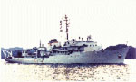 Silas Bent |
| Survey Equipment | Survey Info | Data Type(s) | Data Collected |
|---|---|---|---|
| transitsatellite | --- | Navigation | |
| magnetics | --- | Magnetics | |
| sparker | --- | Sparker | |
| 3.5khz | --- | Sub Bottom Profiler | |
| expendablebatthermograph | --- | Temperature | |
| currentmeter | --- | Current | |
| 12khz | --- | Single Beam |
