AKA: none
Other ID: C-02-12-SC
Status: Completed
Organization(s): USGS, Pacific Coastal and Marine Science Center
Funding Program(s):
Principal Investigator(s): Guy Cochrane
Affiliate Investigator(s):
Information Specialist(s): Nadine Golden
Data Type(s): Imagery: Video
Scientific Purpose/Goals: Video survey for California State Waters Mapping Program
Vehicle(s):
Start Port/Location: Moss Landing
End Port/Location: Moss Landing
Start Date: 2012-08-09
End Date: 2012-08-31
Equipment Used: underwater video
Information to be Derived: Substrate type, epifauna.
Summary of Activity and Data Gathered:
Staff: Guy Cochrane, Peter Dartnell, Mercedes Erdey, Gerry Hatcher
Affiliate Staff:
Lisa Krigsman
Notes:
Staff information imported from InfoBank
Guy Cochrane
Pete Dartnell
Mercedes Erdey - Heydorn
Lisa Krigsman
Gerry Hatcher
Location:
Big Sur to Point Conception
| Boundaries | |||
|---|---|---|---|
| North: 37.26725136 | South: 34.34653427 | West: -122.66697563 | East: -120.25634766 |
Platform(s):
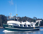 Coral Sea |
Cochrane, G.R., Cole, A., and Sherrier, M., 2022, Bathymetry, backscatter intensity, and benthic habitat offshore of Point Buchon, California: U.S. Geological Survey data release, https://doi.org/10.5066/P9KBGELE.
Cochrane, G.R., Cole, A., Sherrier, M., and Hallahan, S., 2022, Bathymetry, backscatter intensity, and benthic habitat offshore of Point Estero, California: U.S. Geological Survey data release, https://doi.org/10.5066/P9ZSTUK1.
Cochrane, G.R., Cole, A., Sherrier, M., and Roca-Lezra, A., 2022, Bathymetry, backscatter intensity, and benthic habitat offshore of Morro Bay, California: U.S. Geological Survey data release, https://doi.org/10.5066/P9HEZNRO.
Dartnell, P., Maier, K.L., Erdey, M.D., Dieter, B.E., Golden, N.E., Johnson, S.Y., Hartwell, S.R.,, Cochrane, G.R., Ritchie, A.C., Finlayson, D.P., Kvitek, R.G., Sliter, R.W., Greene, H.G., Davenport, C.W., Endris, C.A., and Krigsman, L.M., 2015, California State Waters Map SeriesâMonterey Canyon and vicinity, California: In: Dartnell, P., Cochran, S.A. (Eds.). U.S. Geological Survey Open-File Report 2016-1072, https://doi.org/10.3133/ofr20161072.
FAN C0212SC has data viewable in the CMGP Video and Photograph Portal. View the data in this application here. See the instructions for working with this application.
| Survey Equipment | Survey Info | Data Type(s) | Data Collected |
|---|---|---|---|
| underwater video | --- | Video | C0212SC_video_observations (This part of DS 781 presents video observations from cruise C0212SC in southern California. The vector data file is included in ""c0212sc_video_observations.zip,"" which is accessible from https://pubs.usgs.gov/ds/781/video_observations/data_catalog_video_observations.html.
In 2006 and 2009, the seafloor in central California was mapped by California State University, Monterey Bay, Seafloor Mapping Lab (CSUMB) and by the U.S. Geological Survey (USGS), using both multibeam echosounders and bathymetric sidescan sonar units. These mapping missions combined to collect bathymetry and acoustic-backscatter data from about the 10-m isobath to out beyond the 3-nautical-mile limit of California's State Waters. To validate the interpretations of sonar data in order to turn it into geologically and biologically useful information, the USGS ground-truth surveyed the data by towing camera sleds over specific locations throughout the region. During the 2012 ground-truth cruise, the camera sled housed two video cameras (one forward looking and the other vertical looking), a high-definition video camera, and an 8-megapixel digital still camera. The video was fed in real time to the research vessel, where USGS and NOAA scientists recorded both the geologic and biologic character of the seafloor into programmable keypads once every minute. In addition to recording the seafloor characteristics, a digital still photograph was captured once every 30 seconds. This ArcGIS shape file includes the position of the camera, the time each observation was started, and the visual observations of geologic and biologic habitat.) |
