AKA: none
Other ID: C-1-02-HW,C1-02-HW
Status: Completed
Organization(s): USGS, Pacific Coastal and Marine Science Center, National Park Service
Funding Program(s): USS Arizona Memorial Survey (MU298)
Principal Investigator(s): Patrick Hart, Larry Kooker
Affiliate Investigator(s):
Information Specialist(s): Patrick Hart
Data Type(s): Location-Elevation: Navigation, Seismics: Boomer
Scientific Purpose/Goals: Determine depth to bedrock in vicinity of USS Arizona and USS Utah.
Vehicle(s):
Start Port/Location: Pearl Harbor, HI
End Port/Location: Pearl Harbor, HI
Start Date: 2002-08-22
End Date: 2002-08-23
Equipment Used: Chirp, navigation
Information to be Derived:
Summary of Activity and Data Gathered: One day survey collected 2 CDs of SEG-Y digital seismic profiles.
Staff: Patrick Hart, Larry Kooker
Affiliate Staff:
Matt Russell (National Park Sevice) - Archeologist
Richard Curry (US Navy) - Boat Pilot
Brian Stanley (US Navy) - Deck Hand
Notes:
Staff information imported from InfoBank
Pat Hart (USGS Western Region) - Geophysicist
Larry Kooker (USGS Western Region) - Electronic Technician
Matt Russell (National Park Sevice) - Archeologist
Richard Curry (US Navy) - Boat Pilot
Brian Stanley (US Navy) - Deck Hand
Location:
Hawaii
| Boundaries | |||
|---|---|---|---|
| North: 21.37509 | South: 21.35969 | West: -157.966 | East: -157.9359 |
Platform(s):
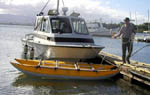 Challenger |
| Survey Equipment | Survey Info | Data Type(s) | Data Collected |
|---|---|---|---|
| Chirp | --- | Boomer | chirp survey information |
| navigation | --- | Navigation | Global positioning system (GPS) data c-1-02-hw.060 (Provisional best file) CD_ROM; navigation and FACS forms (analog holdings) |
