AKA: none
Other ID: C-1-94-NA
Status: Completed
Organization(s):
Funding Program(s): Nearshore Field Experiment (MU203)
Principal Investigator(s): John Dingler
Affiliate Investigator(s):
Information Specialist(s):
Data Type(s): Sonar: Sidescan
Scientific Purpose/Goals: Document bedform change in the nearshore
Vehicle(s):
Start Port/Location:
End Port/Location:
Start Date: 1994-08-01
End Date: 1994-08-20
Equipment Used: Kleinsidescan
Information to be Derived:
Summary of Activity and Data Gathered: Collected side scan sonarpaper records across the nearshore. Instrument location determined by a total station, and the data were stored on disk.
Staff: John Haines, Guy Gelfenbaum
Affiliate Staff:
Notes: (from USGS Bulletin 1/13/95) John Haines (BAMG) and Guy Gelfenbaum (BUSGS), both at the Center for Coastal Geology and Regional Marine Studies in St. Petersburg, Florida, and John Dingler (BUSGS) in Menlo Park, Calif., recently completed an intensive stint at Duck, North Carolina, as part of the DUCK94 Nearshore Field Experiment. This major experiment was hosted by the U.S. Army Corps of Engineers Field Research Facility (FRF) and was jointly sponsored by the Corps of Engineers, the Office of Naval Research, and the USGS. Abby Sallenger represented the USGS on the interagency organizing committee. DUCK94 was the first phase of a two part effort to advance our fundamental understanding of sediment transport in the nearshore zone through integrated field measurements and numerical modeling. The second phase, SANDYDUCK, is scheduled for October 1997. DUCK94 was a series of independently developed investigations, by researchers from 12 universities and 4 government agencies, that were integrated into one large experiment. The scientific efforts in DUCK94 by the USGS included a study of the spatial distribution of bottom roughness as measured by side-scan sonar (Dingler), and a study of the relative contributions from mean currents and waves to the vertical structure of turbulence stress (Haines and Gelfenbaum). The turbulence measurements were made using an array of newly developed acoustic doppler current meters and resulted in nearly 300 mbytes of data daily. Both data sets are unique and will be critical to understanding sediment transport processes in the nearshore environment and ultimately help us to better predict coastal erosion. The large scale of the experiments required support from numerous people, including Terry Kelley, Larry Kooker, Keith Ludwig, Mark Kennedy, Rob Wertz, Bill Townsley, Scott Pendygraft, and Dan Penrod. Many thanks to all.
Staff information imported from InfoBank
John Dingler (USGS Western Region) - Chief Scientist
John Haines (USGS Eastern Region, BAMG, ) - Unspecified
Guy Gelfenbaum (USGS Western Region) - Unspecified
Location:
North Carolina
| Boundaries | |||
|---|---|---|---|
| North: 35.96827 | South: 35.62461 | West: -75.8782 | East: -75.36196 |
Platform(s):
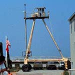 Crab |
| Survey Equipment | Survey Info | Data Type(s) | Data Collected |
|---|---|---|---|
| Kleinsidescan | --- | Sidescan |
