AKA: none
Other ID: C-19-69-NP,C1219
Status: Completed
Organization(s): USGS, Woods Hole Coastal and Marine Science Center
Funding Program(s):
Principal Investigator(s):
Affiliate Investigator(s): S. Lieber
Information Specialist(s):
Data Type(s): Electro-Magnetic: Gravity, Electro-Magnetic: Magnetics, Location-Elevation: Navigation, Seismics: Air Gun / Water Gun, Seismics: Sub Bottom Profiler, Sonar: Single Beam
Scientific Purpose/Goals:
Vehicle(s):
Start Port/Location:
End Port/Location:
Start Date: 1969-07-12
End Date: 1969-08-06
Equipment Used: transitsatellite, magnetics, gravity, 3.5khz, 12khz, airgun
Information to be Derived: Bathymetry, magnetics, seismic, and gravity data.
Summary of Activity and Data Gathered:
Staff:
Affiliate Staff:
Notes: Lamont-Doherty
Staff information imported from InfoBank
S. Lieber - Chief Scientist
Location:
Hakodate, Japan
| Boundaries | |||
|---|---|---|---|
| North: 41.4164 | South: 41.2955 | West: 143.0163 | East: 144.49609 |
Platform(s):
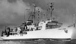 Robert D Conrad |
| Survey Equipment | Survey Info | Data Type(s) | Data Collected |
|---|---|---|---|
| transitsatellite | --- | Navigation | Integrated navigation (SINS) data c-19-69-np.050 (Provisional best file) |
| magnetics | --- | Magnetics | Edited magnetics data c-19-69-np.221_050 (Provisional best file) |
| gravity | --- | Gravity | Free Air Anomaly data c-19-69-np.160_050 (Provisional best file) |
| 3.5khz | --- | Sub Bottom Profiler | Edited bathymetry data with corrected depths c-19-69-np.320_050 (Provisional best file) 35mm microfilm- bathymetry (analog holdings) bathy? records (scanned microfiln) |
| 12khz | --- | Single Beam | |
| airgun | --- | Air Gun / Water Gun |
