AKA: none
Other ID: C-4-74-SA,C1704
Status: Completed
Organization(s):
Funding Program(s):
Principal Investigator(s):
Affiliate Investigator(s): A. Amos,J. Weissel
Information Specialist(s):
Data Type(s): Location-Elevation: Navigation
Scientific Purpose/Goals:
Vehicle(s):
Start Port/Location:
End Port/Location:
Start Date: 1974-01-05
End Date: 1974-02-19
Equipment Used: navigation
Information to be Derived:
Summary of Activity and Data Gathered:
Staff:
Affiliate Staff:
Notes: Lamont-Doherty
Staff information imported from InfoBank
A. Amos - Chief Scientist
J. Weissel - Chief Scientist
Location:
South Afri
| Boundaries | |||
|---|---|---|---|
| North: -34 | South: -67 | West: 18 | East: 70 |
Platform(s):
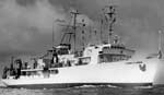 Robert D Conrad |
| Survey Equipment | Survey Info | Data Type(s) | Data Collected |
|---|---|---|---|
| navigation | --- | Navigation |
