AKA: none
Other ID: D-01-12-PS
Status: Completed
Organization(s): USGS, Pacific Coastal and Marine Science Center
Funding Program(s):
Principal Investigator(s): Renee Takesue
Affiliate Investigator(s):
Information Specialist(s): Andrew Stevens
Data Type(s): Imagery: Video, Location-Elevation: Navigation, Sonar: Single Beam
Scientific Purpose/Goals: Make a vegetation map of eelgrass in the Nisqually Delta
Vehicle(s):
Start Port/Location: Nisqually River Delta, South Puget Sound, Washington
End Port/Location: Nisqually River Delta, South Puget Sound, Washington
Start Date: 2012-02-15
End Date: 2012-02-21
Equipment Used: Camera-video, GPS, single beam sonar 180-280KHz
Information to be Derived: Spatial distribution of eelgrass in the Nisqually Delta
Summary of Activity and Data Gathered:
Staff: Eric Grossman, Andrew Stevens, Renee Takesue
Affiliate Staff:
George Kaminsky (Wash. State Dept. of Ecology) - Coastal Engineer
Heather Baron (Wash. State Dept. of Ecology) - Coastal Scientist
Andrew Ryan (Wash. State Dept. of Ecology) - Field Technician
Brian Pickering (Wash. State Dept. of Ecology) - Boat Captain
Notes: data on internal backup 2012/D-01-12-PS/rawdata
Staff information imported from InfoBank
Renee Takesue (PCMSC, )
Andrew Stevens (PCMSC, )
Eric Grossman (USGS PCMSC) - Geologist
George Kaminsky (Wash. State Dept. of Ecology) - Coastal Engineer
Heather Baron (Wash. State Dept. of Ecology) - Coastal Scientist
Andrew Ryan (Wash. State Dept. of Ecology) - Field Technician
Brian Pickering (Wash. State Dept. of Ecology) - Boat Captain
Location:
Washington
| Boundaries | |||
|---|---|---|---|
| North: 47.17304165 | South: 47.07422782 | West: -122.79004745 | East: -122.63606921 |
Platform(s):
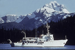 George Davidson |
Stevens, A.W., Takesue, R.K., and Grossman, E.E., 2020, Eelgrass distributions and bathymetry of the Nisqually River delta, Washington: U.S. Geological Survey data release, https://doi.org/10.5066/P9N9K2I1.
| Survey Equipment | Survey Info | Data Type(s) | Data Collected |
|---|---|---|---|
| Camera-video | --- | Photo Video | Eelgrass distributions derived from a towed underwater video survey of the Nisqually River delta, 2012 (This portion of the USGS data release presents eelgrass distributions derived from towed underwater video surveys of the Nisqually River delta, Washington in 2012 (USGS Field Activity Number D-01-12-PS). Eelgrass data were collected from the R/V George Davidson equipped with a towed underwater video system and global navigation satellite system (GNSS) receiver. The underwater video system consisted of a Splashcam standard definition video camera connected to a Sony GV-D1000 video monitor and tape recorder. Positioning of the survey vessel was determined at 1 Hz intervals using a Trimble R7 GNSS receiver and Trimble Zephyr Model 2 antenna. The positioning data from the GNSS were encoded onto the audio track of the digital video recording using Red Hen Systems (RHS) VMS200 hardware. Underwater video data were recorded as the vessel navigated along a series of shore-perpendicular transects at speeds between 1 and 2 knots. The underwater video recording was later reviewed and the presence or absence of eelgrass was determined for each 1-s segment of video tape. These data were used to evaluate the classification of single-beam sonar data acquired during the same time period.) |
| GPS | --- | Navigation | Global positioning system (GPS) data d-01-12-ps.064 (Provisional best file) |
| single beam sonar 180-280KHz | --- | Single Beam | Eelgrass distributions and bathymetry derived from an acoustic survey of the Nisqually River delta, Washington, 2012 (This portion of the USGS data release presents eelgrass distribution and bathymetry data derived from acoustic surveys of the Nisqually River delta, Washington in 2012 (USGS Field Activity Number D-01-12-PS). Eelgrass and bathymetry data were collected from the R/V George Davidson equipped with a single-beam sonar system and global navigation satellite system (GNSS) receiver. ) |
