AKA: none
Other ID: D-1-64-SC
Status: Completed
Organization(s):
Funding Program(s):
Principal Investigator(s): Roland VonHuene
Affiliate Investigator(s):
Information Specialist(s):
Data Type(s): Location-Elevation: Navigation, Seismics: Sparker, Sonar: Single Beam
Scientific Purpose/Goals:
Vehicle(s):
Start Port/Location:
End Port/Location:
Start Date: 1964-11-23
End Date: 1964-11-28
Equipment Used: 12khz, navigation, Sparker, sparker
Information to be Derived:
Summary of Activity and Data Gathered: scanned microfilm on FAD
Staff:
Affiliate Staff:
Notes:
Staff information imported from InfoBank
Roland Von Huene (USGS Western Region) - Chief Scientist
Location:
San Miguel Island area
| Boundaries | |||
|---|---|---|---|
| North: 34.75 | South: 32.25 | West: -122.75 | East: -116.75 |
Platform(s):
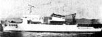 Davis |
| Survey Equipment | Survey Info | Data Type(s) | Data Collected |
|---|---|---|---|
| 12khz | --- | Single Beam | |
| navigation | --- | Navigation | D-1-64-SC_154105_navplot (scanned microfilm) |
| Sparker | --- | Sparker | |
| sparker | --- | Sparker | D-1-64-SC_154105_seismic (scanned microfilm) |
