AKA: none
Other ID: D-1-65-BS
Status: Completed
Organization(s):
Funding Program(s):
Principal Investigator(s): Alan Cooper, Mike Marlow, David Scholl, Roland VonHuene
Affiliate Investigator(s):
Information Specialist(s):
Data Type(s): Location-Elevation: Navigation, Seismics: Multichannel, Sonar: Single Beam
Scientific Purpose/Goals:
Vehicle(s):
Start Port/Location:
End Port/Location:
Start Date: 1965-06-17
End Date: 1965-07-02
Equipment Used: Other, bathymetry, navigation, multichannel
Information to be Derived:
Summary of Activity and Data Gathered: bathy data type added; from microfilm scans. updated PI to R. Von Huene and dates to 6/17/65-6/24/65 from scanned microfilm and Cooper/Marlow 6/28/65 - 7/2/65 (from scanned microfilm) Seismic reflection profiles scanned microfilm exists
Staff:
Affiliate Staff:
Notes: Staff information imported from InfoBank
Dave Scholl (USGS Western Region) - Chief Scientist
Location:
Bering Sea
| Boundaries | |||
|---|---|---|---|
| North: 63.47636553 | South: 52.103 | West: -178.301 | East: -165.75 |
Platform(s):
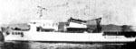 Davis |
| Survey Equipment | Survey Info | Data Type(s) | Data Collected |
|---|---|---|---|
| Other | --- | --- | --- |
| bathymetry | --- | Single Beam | |
| navigation | --- | Navigation | Integrated navigation (SINS) data d-1-65-bs.050 (Provisional best file) |
| multichannel | --- | Multichannel | D-01-65-BS_156528_misc_seis (scanned microfilm) seismic |
