AKA: none
Other ID: D-1-65-MX
Status: Completed
Organization(s): USGS, Pacific Coastal and Marine Science Center, Scripps Institution Of Oceanography, La Jolla, Ca
Funding Program(s): Southern California Continental Borderland (MU270)
Principal Investigator(s): George Moore
Affiliate Investigator(s):
Information Specialist(s):
Data Type(s): Seismics: Air Gun / Water Gun
Scientific Purpose/Goals: Seismic profiling.
Vehicle(s):
Start Port/Location:
End Port/Location:
Start Date: 1965-02-11
End Date: 1965-02-26
Equipment Used: airgunarcer
Information to be Derived: Seismic reflection profiles
Summary of Activity and Data Gathered:
Staff:
Affiliate Staff:
Notes: Scripps Institute of Oceanography
Staff information imported from InfoBank
George Moore (USGS Western Region) - Chief Scientist
Location:
Mexico
| Boundaries | |||
|---|---|---|---|
| North: 32.75 | South: 15.25 | West: -117.75 | East: -98.25 |
Platform(s):
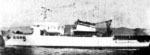 Davis |
| Survey Equipment | Survey Info | Data Type(s) | Data Collected |
|---|---|---|---|
| airgunarcer | --- | Air Gun / Water Gun |
