AKA: none
Other ID: D-1-79-EG,DC179EG
Status: Completed
Organization(s): USGS, Pacific Coastal and Marine Science Center
Funding Program(s):
Principal Investigator(s): Bruce Molnia, Mark Wheeler
Affiliate Investigator(s):
Information Specialist(s):
Data Type(s): Location-Elevation: Navigation, Sampling: Geology, Seismics: Sub Bottom Profiler, Sonar: Single Beam
Scientific Purpose/Goals: Sediment samples and cores for microfossil study
Vehicle(s):
Start Port/Location:
End Port/Location:
Start Date: 1979-05-24
End Date: 1979-06-01
Equipment Used: Shipekgrab, navigation, 3.5khz, gravitycore
Information to be Derived: Bathymetry, samples, microfossils.
Summary of Activity and Data Gathered:
Staff:
Affiliate Staff:
Notes: Staff information imported from InfoBank
Mark Wheeler - Chief Scientist
Bruce Molnia (USGS Western Region) - Chief Scientist
Location:
Eastern Gulf of Alaska
| Boundaries | |||
|---|---|---|---|
| North: 60 | South: 57.25 | West: -142 | East: -135 |
Platform(s):
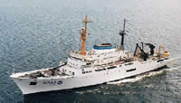 Discoverer |
Schreppel, H.A., Degnan, C.H, Dadisman, S.V., and Metzger, D.R., 2013, Archive of U.S. Geological Survey Selected Single-Beam Bathymetry Datasets, 1969â2000: U.S. Geological Survey Data Series 757, http://pubs.usgs.gov/ds/757/.
| Survey Equipment | Survey Info | Data Type(s) | Data Collected |
|---|---|---|---|
| Shipekgrab | --- | Geology | sample locations |
| navigation | --- | Navigation | Integrated navigation (SINS) data d-1-79-eg.051 (Provisional best file) start end of lines |
| 3.5khz | --- | Sub Bottom Profiler | NGDC MGD77 data Raw depth (bathymetry) data d-1-79-eg.305_051 (Provisional best file) |
| gravitycore | --- | Geology |
