AKA: none
Other ID: D-1-80-NA
Status: Completed
Organization(s):
Funding Program(s):
Principal Investigator(s): Jim Gardner
Affiliate Investigator(s):
Information Specialist(s):
Data Type(s): Sonar: Single Beam, Seismics: Air Gun / Water Gun, Sonar: Sidescan
Scientific Purpose/Goals:
Vehicle(s):
Start Port/Location:
End Port/Location:
Start Date: 1980-07-09
End Date: 1980-07-21
Equipment Used: 10khz, airgun, sidescansonar
Information to be Derived:
Summary of Activity and Data Gathered:
Staff:
Affiliate Staff:
Notes: Discovery Cruise III
Staff information imported from InfoBank
Jim Gardner (USGS Western Region) - Chief Scientist
Location:
Northern Atlantic
| Boundaries | |||
|---|---|---|---|
| North: 66.75 | South: -4.75 | West: -99.75 | East: 17.75 |
Platform(s):
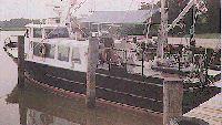 Discovery |
| Survey Equipment | Survey Info | Data Type(s) | Data Collected |
|---|---|---|---|
| 10khz | --- | Single Beam | |
| airgun | --- | Air Gun / Water Gun | |
| sidescansonar | --- | Sidescan |
