AKA: none
Other ID: D-1-81-EG
Status: Completed
Organization(s):
Funding Program(s):
Principal Investigator(s): Homa Lee, Monty Hampton
Affiliate Investigator(s):
Information Specialist(s): PARTNER
Data Type(s): Seismics: Sparker, Seismics: Air Gun / Water Gun, Sonar: Sidescan, Seismics: Sub Bottom Profiler, Sonar: Single Beam, Sampling: Geology, Location-Elevation: Navigation
Scientific Purpose/Goals:
Vehicle(s):
Start Port/Location: Seattle, WA for Alsek R.
End Port/Location: Kodiak, AK
Start Date: 1981-04-23
End Date: 1981-05-01
Equipment Used: minisparker, airgun, sidescansonar, 3.5khz, 12khz, Alpinecore, VanVeengrab, gravitycore, LoranC, transitsatellite
Information to be Derived:
Summary of Activity and Data Gathered:
Staff:
Affiliate Staff:
Notes:
Staff information imported from InfoBank
Homa Lee (USGS Western Region) - Chief Scientist
Monty Hampton (USGS Western Region) - Chief Scientist
Non USGS data manager = Beckie Larsen
Location:
Eastern Gulf of Alaska
| Boundaries | |||
|---|---|---|---|
| North: 60 | South: 57.25 | West: -142 | East: -133 |
Platform(s):
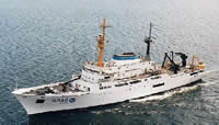 Discoverer |
| Survey Equipment | Survey Info | Data Type(s) | Data Collected |
|---|---|---|---|
| minisparker | --- | Sparker | on off minisparker information |
| airgun | --- | Air Gun / Water Gun | |
| sidescansonar | --- | Sidescan | |
| 3.5khz | --- | Sub Bottom Profiler | navigation line numbers |
| 12khz | --- | Single Beam | start and end of paper rolls |
| Alpinecore | --- | Geology | 607a1 information all sample information sample information |
| VanVeengrab | --- | Geology | All sample information sample information 622V1 description |
| gravitycore | --- | Geology | All sample information (html page) G601 description core information |
| LoranC | --- | Navigation | |
| transitsatellite | --- | Navigation | Integrated navigation (SINS) data d-1-81-eg.052 (Provisional best file) |
