AKA: none
Other ID: D-E-72-NA
Status: Completed
Organization(s):
Funding Program(s): Equatorial Atlantic Project (MU100)
Principal Investigator(s):
Affiliate Investigator(s):
Information Specialist(s):
Data Type(s): Location-Elevation: Navigation
Scientific Purpose/Goals:
Vehicle(s):
Start Port/Location:
End Port/Location:
Start Date: 1972-04-02
End Date: 1972-06-23
Equipment Used: navigation
Information to be Derived:
Summary of Activity and Data Gathered:
Staff:
Affiliate Staff:
Notes: National Oceanic and Atmospheric Association (NOAA)/ Atlantic Oceanographic and Meteorological Laboratory (AOML)
Location:
North Atlantic
| Boundaries | |||
|---|---|---|---|
| North: 26.65 | South: 9 | West: -76.4422 | East: -40.0001 |
Platform(s):
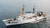 Discoverer |
| Survey Equipment | Survey Info | Data Type(s) | Data Collected |
|---|---|---|---|
| navigation | --- | Navigation |
