AKA: none
Other ID: E-1-01-SC
Status: Completed
Organization(s): USGS, Pacific Coastal and Marine Science Center, Seafloor Surveys, Inc., Subsea Systems
Funding Program(s):
Principal Investigator(s): Brian Edwards
Affiliate Investigator(s):
Information Specialist(s):
Data Type(s): Location-Elevation: Navigation, Seismics: Boomer, Seismics: Multichannel
Scientific Purpose/Goals:
Vehicle(s):
Start Port/Location:
End Port/Location:
Start Date: 2001-01-08
End Date: 2001-01-13
Equipment Used: Geopulse, GPS, 24channel
Information to be Derived:
Summary of Activity and Data Gathered:
Staff: Patrick Hart, Larry Kooker, Jonathan Childs
Affiliate Staff:
Michael Barth (Subsea Systems) - Party Chief
Muriel Norton (Subsea Systems) - Shore Support
Sean Galway (Seafloor Surveys
Inc.) - Delph/Elics Operator
Mark Barnum (Southwest Scientific) - Navigator
Orin Jewett (
Noble Consultants
) - Bathymetry Operator
Kenny Nielsen (Seaventures) - Captain
Jim Everett (Seaventures) - Deckhand
Notes:
Staff information imported from InfoBank
Jon Childs (USGS Western Region) - Geophysicist
Brian Edwards (Geologist, USGS Western Region) - Chief Scientist
Larry Kooker (USGS Western Region) - Electronic Technician
Pat Hart (USGS Western Region) - Geophysicist
Michael Barth (Subsea Systems) - Party Chief
Muriel Norton (Subsea Systems) - Shore Support
Sean Galway (Seafloor Surveys, Inc.) - Delph/Elics Operator
Mark Barnum (Southwest Scientific) - Navigator
Orin Jewett (, Noble Consultants, ) - Bathymetry Operator
Kenny Nielsen (Seaventures) - Captain
Jim Everett (Seaventures) - Deckhand
Location:
CA
| Boundaries | |||
|---|---|---|---|
| North: 33.77632 | South: 33.70975 | West: -118.277 | East: -118.10124 |
Platform(s):
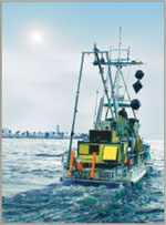
 Early Bird |
Ehman, K.D., and Edwards, B.D., 2017, A Foundation for Future Assessment and Management of Groundwater Resources: , AAPG Datapages, Inc., Search and Discovery. AAPG, Houston, TX URL: http://www.searchanddiscovery.com/pdfz/documents/2017/80599ehman/ndx_ehman.pdf.html.
FAN E101SC has data viewable in the GeoMappApp/Virtual Ocean applications. To view this data in these applications go to http://www.geomapapp.org/ and http://www.virtualocean.org/. See the instructions for locating USGS data in these applications. You can also view the imagery created from the SEGY data at https://cmgds.marine.usgs.gov/images.php?cruise=E101SC.
| Survey Equipment | Survey Info | Data Type(s) | Data Collected |
|---|---|---|---|
| Geopulse | --- | Boomer | high resolution survey information (start and end of line) |
| GPS | --- | Navigation | Survey information (start and end of lines) Global positioning system (GPS) data e-1-01-sc.064 (Provisional best file) |
| 24channel | --- | Multichannel | NAMSS Air gun data Survey information (24 channel) |