AKA: none
Other ID: EW9410,E-10-94-BS
Status: Completed
Organization(s): Lamont Doherty Earth Observatory
Funding Program(s): Deep Seismic Investigation of the Continental Crust, Bering and Chukchi Seas, Alaska (MU084)
Principal Investigator(s):
Affiliate Investigator(s): Simon Klemperer (Stanford University)
Information Specialist(s): Jonathan Childs
Data Type(s): Seismics: Multichannel, Seismics: Sonobuoy, Electro-Magnetic: Gravity, Electro-Magnetic: Magnetics, Seismics: Sub Bottom Profiler
Scientific Purpose/Goals: Stanford University, in conjunction with the U.S. Geological Survey, and with participation by the Institute of the Lithosphere and the Institute of Oceanology of the Russian Academy of Sciences, and the Geodynamics Research Institute of Texas A&M University, conducted deep seismic investigations of the continental crust beneath the Bering and Chukchi seas, Alaska, during the month of August, 1994.
Vehicle(s):
Start Port/Location: Dutch Harbor, AK
End Port/Location: Dutch Harbor, AK
Start Date: 1994-08-06
End Date: 1994-09-01
Equipment Used: multichannel, sonobuoy, gravity, magnetics, 3.5khz
Information to be Derived:
Summary of Activity and Data Gathered: Cruise Report (.pdf) STANFORD UNIVERSITY, IN CONJUNCTION WITH THE U.S. GEOLOGICAL SURVEY, AND WITH PARTICIPATION BY THE INSTITUTE OF THE LITHOSPHERE AND THE INSTITUTE OF OCEANOLOGY OF THE RUSSIAN ACADEMY OF SCIENCES, AND THE GEODYNAMICS RESEARCH INSTITUTE OF TEXAS A&M UNIVERSITY, CONDUCTED DEEP SEISMIC INVESTIGATIONS OF THE CONTINENTAL CRUST BENEATH THE BERING AND CHUKCHI SEAS, ALASKA, DURING THE MONTH OF AUGUST, 1994. THE DATA WAS RECORDED TO TWO-WAY TRAVEL-TIMES OF 15 TO 23 SECONDS, WITH 50 TO 75 METER SHOT SPACING. TWO NORTH-SOUTH TRANSECTS WERE PROFILED. THE EASTERN TRANSECT EXTENDED FROM 58(50N, 169(32W, WELL WITHIN THE CONTINENTAL SHELF OF THE BERING SEA, NORTH OF THE PRIBILOF ISLANDS, TO JUST SOUTH OF THE SHELF EDGE NORTH OF BARROW, ALASKA, AT 71(49N, 154(33W. ICE PREVENTED CONTINUATION OF THE LINE BEYOND THE SHELF EDGE. THE WESTERN TRANSECT EXTENDED FROM THE CENTRAL CHUKCHI SEA, WELL WITHIN THE SHELF AT 71(23N, 163(00W, INTO THE ALEUTIAN BASIN AT 58(00N, 178(30W, NEAR NAVARINSKY CANYON. AN ADDITIONAL SHORT LINE CROSSING OVER THE BERINGIAN MARGIN A SECOND TIME WAS RECORDED NEAR ZEMCHUG CANYON EAST OF THE WESTERN TRANSECT. THE PROFILES CROSS IMPORTANT STRIKE-SLIP FAULTS, POSSIBLE TERRANE BOUNDARIES, TWO CONTINENTAL MARGINS, AND SEVERAL CRETACEOUS/TERTIARY SEDIMENTARY BASINS (NORTON, HOPE, CHUKCHI, AND NAVARIN BASINS). TOGETHER WITH THE PRECEDING CRUISE EW94-09, THE PROFILES PROVIDE A CONTINUOUS TRANSECT ACROSS THE NORTH AMERICAN CONTINENT, FROM THE PACIFIC TO THE ARCTIC OCEAN (SEE FIGURES 7 THROUGH 9 FOR DATA EXAMPLES). MOST OF THE MULTI-CHANNEL SEISMIC (MCS) DATA IS OF HIGH QUALITY, BUT BAD WEATHER, STRONG CURRENTS, AND RECORDING PROBLEMS SOMETIMES PRESENTED DIFFICULTIES DURING DATA ACQUISITION. GRAVITY, MAGNETIC, AND SONOBUOY DATA WERE ALSO RECORDED ALONG THE PROFILES. WIDE-ANGLE RECORDING WAS DONE IN CONJUNCTION WITH THE SEISMIC PROFILING, AT RECORDING SITES LOCATED ALONG THE CENTRAL WEST COAST OF ALASKA AND THE CHUKCHI PENINSULA, AS WELL AS ON ISLANDS IN THE BERING STRAIT AND BERING SEA.
Staff: Jonathan Childs, Bill Robinson
Affiliate Staff:
Brian Galloway (Stanford University) - Geophysicist
Nikita Bogdanov (Institute of the Lithosphere
Russian Academy of Sciences) - Geologist
Helios Gnibidenko (Institute of Oceanology
Russian Academy of Sciences) - Geophysicist
Terri Plake (Western Washington University) - Geologist
Arsenio Tepano (Western Washington University) - Watchstander
Marian Cline (Princeton University) - Watchstander
Joe Stennett (LDEO) - Science Officer
Brian McKenna (Digicon Inc.) - Computer Technician
Notes:
Staff information imported from InfoBank
Simon Klemperer (Stanford University) - Chief Scientist
Jon Childs (USGS Western Region) - Geophysicist
Brian Galloway (Stanford University) - Geophysicist
Nikita Bogdanov (Institute of the Lithosphere, Russian Academy of Sciences) - Geologist
Helios Gnibidenko (Institute of Oceanology, Russian Academy of Sciences) - Geophysicist
Terri Plake (Western Washington University) - Geologist
Arsenio Tepano (Western Washington University) - Watchstander
Marian Cline (Princeton University) - Watchstander
Joe Stennett (LDEO) - Science Officer
Bill Robinson (LDEO) - Data Analyst
Brian McKenna (Digicon Inc.) - Computer Technician
Location:
Chukchi Sea
| Boundaries | |||
|---|---|---|---|
| North: 71.82599 | South: 53.84387 | West: -178.4992 | East: -154.28032 |
Platform(s):
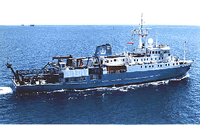 Maurice Ewing |
Brocher, T.M., Allen, R.M., Stone, D.B., Wolf, L.W., and Galloway, B.K., 1995, Data report for onshore-offshore wide-angle seismic recordings in the Bering-Chukchi Sea, western Alaska and eastern Siberia: U.S. Geological Survey Open-File Report 95-650, 57 p., http://pubs.er.usgs.gov/publication/ofr95650.
| Survey Equipment | Survey Info | Data Type(s) | Data Collected |
|---|---|---|---|
| multichannel | --- | Multichannel | |
| sonobuoy | --- | Sonobuoy | |
| gravity | --- | Gravity | |
| magnetics | --- | Magnetics | |
| 3.5khz | --- | Sub Bottom Profiler |
