AKA: none
Other ID: E-1-54-AA
Status: Completed
Organization(s):
Funding Program(s):
Principal Investigator(s): G.D. Fraser
Affiliate Investigator(s):
Information Specialist(s):
Data Type(s):
Scientific Purpose/Goals:
Vehicle(s):
Start Port/Location:
End Port/Location:
Start Date: 1954-01-01
End Date: 1954-01-01
Equipment Used:
Information to be Derived:
Summary of Activity and Data Gathered:
Staff: G.D. Fraser, H.F. Barnett, Harald Drewes, W.B. Bryan, C.E. Chapin, Charles Best
Affiliate Staff:
G.L. Snyder
R.P. Plattr
H.B. Smith
Carl Vevelstad - captain
Notes: Geological reconnaissance of Unalaska Island occurred during the summer of 1954
Staff information imported from InfoBank
G.D. Fraser
G.L. Snyder
H.F. Barnett
Harald Drewes
R.P. Plattr
H.B. Smith
W.B. Bryan
C.E. Chapin
Carl Vevelstad - captain
Charles Best - engineer
Location:
Alaska
| Boundaries | |||
|---|---|---|---|
| North: 59.75 | South: 45.25 | West: 165.25 | East: -150.25 |
Platform(s):
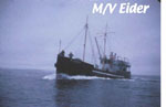 Eider |
