AKA: none
Other ID: E-1-80-SP
Status: Completed
Organization(s):
Funding Program(s): Antarctic Seismic Data Library System (SDLS) (MU010)
Principal Investigator(s): Alan Cooper
Affiliate Investigator(s):
Information Specialist(s):
Data Type(s): Sonar: Single Beam, Electro-Magnetic: Gravity, Electro-Magnetic: Magnetics
Scientific Purpose/Goals:
Vehicle(s):
Start Port/Location:
End Port/Location:
Start Date: 1980-01-23
End Date: 1980-02-19
Equipment Used: bathymetry, gravity, magnetics
Information to be Derived:
Summary of Activity and Data Gathered:
Staff:
Affiliate Staff:
Notes: German Geological Survey; Bundesanstalt fur Geowissenschaften und Rohstoffe (BGR) (german)
Staff information imported from InfoBank
Alan Cooper (USGS Western Region) - Chief Scientist
Location:
Southern Pacific
| Boundaries | |||
|---|---|---|---|
| North: -69.08522 | South: -78.19536 | West: 160.7121 | East: -165.16286 |
Platform(s):
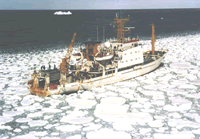 Explora |
| Survey Equipment | Survey Info | Data Type(s) | Data Collected |
|---|---|---|---|
| bathymetry | --- | Single Beam | seismic (data on FAD) |
| gravity | --- | Gravity | |
| magnetics | --- | Magnetics |
