AKA: none
Other ID: E-1-99-GB
Status: Completed
Organization(s):
Funding Program(s): National Seafloor Mapping and Benthic Habitat Studies (MU195)
Principal Investigator(s): Paul Carlson
Affiliate Investigator(s):
Information Specialist(s):
Data Type(s): Sampling: Geology, Location-Elevation: Navigation, Sonar: Single Beam
Scientific Purpose/Goals: Ground truth areas of side-scan in areas of Glacier Bay
Vehicle(s):
Start Port/Location:
End Port/Location:
Start Date: 1999-07-09
End Date: 1999-07-14
Equipment Used: VanVeengrab, GPS, bathymetry
Information to be Derived: Sediment type
Summary of Activity and Data Gathered:
Staff:
Affiliate Staff:
Eric Lunde (BRD) - Boat Driver
Notes:
Staff information imported from InfoBank
Paul Carlson (USGS Western Region) - Chief Scientist
Eric Lunde (BRD) - Boat Driver
Location:
Alaska
| Boundaries | |||
|---|---|---|---|
| North: 58.61717 | South: 58.44017 | West: -136.1825 | East: -135.87167 |
Platform(s):
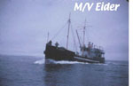 Eider |
| Survey Equipment | Survey Info | Data Type(s) | Data Collected |
|---|---|---|---|
| VanVeengrab | --- | Geology | sample number, location, descriptions |
| GPS | --- | Navigation | Global positioning system (GPS) data e-1-99-gb.060 (Provisional best file) start and end of lines (on off file) |
| bathymetry | --- | Single Beam |
