AKA: none
Other ID: EW9407,E-7-94-NC
Status: Completed
Organization(s): Lamont Doherty Earth Observatory
Funding Program(s):
Principal Investigator(s):
Affiliate Investigator(s): Simon Klemperer, Alan Levander
Information Specialist(s): PARTNER, Sam Clarke
Data Type(s): Seismics: Sub Bottom Profiler, Electro-Magnetic: Gravity, Electro-Magnetic: Magnetics, Seismics: Air Gun / Water Gun, Sonar: Multibeam
Scientific Purpose/Goals: multi-channel seismic (MCS) data acquisition phase of the joint NSF-USGS EDGE experiment in the Mendocino triple junction area of northern California.
Vehicle(s):
Start Port/Location:
End Port/Location: 11, 1994 - San Francisco, CA and 25, 1994 - Eureka, CA
Start Date: 1994-06-11
End Date: 1994-06-25
Equipment Used: 3.5khz, gravity, magnetics, airgun, multibeam
Information to be Derived:
Summary of Activity and Data Gathered:
Staff:
Affiliate Staff:
Simon Klemperer
Alan Levander
Notes:
Staff information imported from InfoBank
Simon Klemperer
Alan Levander
Trehu
Non USGS data manager = Ann Meltzer
Location:
northern California
| Boundaries | |||
|---|---|---|---|
| North: 41.76764 | South: 37.76304 | West: -125.8284 | East: -122.38076 |
Platform(s):
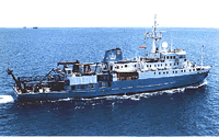 Maurice Ewing |
| Survey Equipment | Survey Info | Data Type(s) | Data Collected |
|---|---|---|---|
| 3.5khz | --- | Sub Bottom Profiler | |
| gravity | --- | Gravity | |
| magnetics | --- | Magnetics | |
| airgun | --- | Air Gun / Water Gun | |
| multibeam | --- | Multibeam |
