AKA: none
Other ID: F-01-11-NC
Status: Completed
Organization(s): National Oceanic and Atmospheric Administration, Gulf of the Farallones National Marine Sanctuary
Funding Program(s):
Principal Investigator(s): Guy Cochrane
Affiliate Investigator(s):
Information Specialist(s): Guy Cochrane
Data Type(s): Location-Elevation: Navigation, Sonar: Multibeam, Sonar: Sidescan
Scientific Purpose/Goals: Sea Floor Habitat Mapping
Vehicle(s):
Start Port/Location: Bodega Bay
End Port/Location: Bodega Bay
Start Date: 2011-09-06
End Date: 2011-09-21
Equipment Used: GPS, Reson Multibeam Sonar, sidescansonar
Information to be Derived: Bathymetry and backscatter intensity data.
Summary of Activity and Data Gathered:
Staff: Guy Cochrane, David Finlayson
Affiliate Staff:
Notes: overview_log.xls Cochrane 8/12/11
Staff information imported from InfoBank
Guy Cochrane
David Finlayson
Location:
Farallone Escarpment
| Boundaries | |||
|---|---|---|---|
| North: 38.33101 | South: 37.64819 | West: -123.436 | East: -122.41763 |
Platform(s):
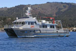 Fulmar |
Dartnell, P., Cochrane, G.R., and Finlayson, D.P., 2014, Bathymetry, acoustic backscatter, and seafloor character of Farallon Escarpment and Rittenburg Bank, northern California: U.S. Geological Survey Open-File Report 2014-1234, 18 p.
| Survey Equipment | Survey Info | Data Type(s) | Data Collected |
|---|---|---|---|
| GPS | --- | Navigation | Global positioning system (GPS) data f-01-11-nc.063 (Provisional best file) Best file with nav in ArcInfo E00 format |
| Reson Multibeam Sonar | --- | Multibeam | |
| sidescansonar | --- | Sidescan |
