AKA: none
Other ID: F-1-02-NC
Status: Completed
Organization(s): USGS, Pacific Coastal and Marine Science Center
Funding Program(s): Englebright Lake Project (MU098)
Principal Investigator(s): Noah Snyder, Jonathan Childs
Affiliate Investigator(s):
Information Specialist(s):
Data Type(s): Imagery: Photo, Location-Elevation: Navigation, Sampling: Geology, Sonar: Single Beam
Scientific Purpose/Goals: Sediment analysis
Vehicle(s):
Start Port/Location: Englebright Lake, CA
End Port/Location: Englebright Lake, CA
Start Date: 2002-04-01
End Date: 2002-04-04
Equipment Used: VanVeengrab, YoNav, underwatercamera, bathymetry
Information to be Derived: Grain size, bathymetry, sediment thickness
Summary of Activity and Data Gathered:
Staff: Michael Boyle, Henry Chezar, Larry Kooker, Gerry O'Brien, Noah Snyder, Jonathan Childs
Affiliate Staff:
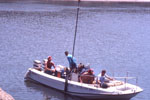
Notes: Oz Houseboat was also used.
Staff information imported from InfoBank
Jon Childs (geophysicist, USGS Menlo Park) - Project Chief
Noah Snyder (geologist, USGS Santa Cruz) - Project Chief
Larry Kooker (USGS Menlo Park) - Electronic technician
Mike Boyle (USGS Menlo Park) - Electronic technician
Gerry O'Brien (USGS Menlo Park) - Boat handler
Hank Chezar (USGS Menlo Park) - Photographic specialist
Location:
Northern California
| Boundaries | |||
|---|---|---|---|
| North: 39.29994 | South: 39.24029 | West: -121.275 | East: -121.20514 |
Platform(s):
 Fast Eddy (SC) |
Childs, J.R., Snyder, N.P., and Hampton, M.A., 2003, Bathymetric and geophysical surveys of Englebright Lake, Yuba-Nevada Counties, California: U.S. Geological Survey Open-File Report 03-383, http://pubs.usgs.gov/of/2003/0383/.
Snyder, N.P., Allen, J.R., Dare, C., Hampton, M.A., Schneider, G., Wooley, R.J., Alpers, C.N., and Marvin-DiPasquale, M.C., 2004, Sediment Grain-Size and Loss-on-Ignition Analyses from 2002 Englebright Lake Coring and Sampling Campaigns: U.S. Geological Survey Open-File Report 2004-1080, http://pubs.er.usgs.gov/publication/ofr20041080.
Snyder, N.P., Rubin, D.M., Alpers, C.N., Childs, J.R., Curtis, J.A., Flint, L.E., and Wright, S.A., 2004, Estimating accumulation rates and physical properties of sediment behind a dam: Englebright Lake, Yuba River, northern California: Water Resources Research, v. 40 no. 11, doi: 10.1029/2004wr003279.
Snyder, N.P., Wright, S.A., Alpers, C.N., Flint, L.E., Holmes, C.W., and Rubin, D.M., 2006, Reconstructing depositional processes and history from reservoir stratigraphy: Englebright Lake, Yuba River, northern California: Journal of Geophysical Research, v. 111 no. F4, doi: 10.1029/2005JF000451.
| Survey Equipment | Survey Info | Data Type(s) | Data Collected |
|---|---|---|---|
| VanVeengrab | --- | Geology | Station Information |
| YoNav | --- | Navigation | Best file with nav in ArcInfo E00 format Global positioning system (GPS) data f-1-02-nc.061 (Provisional best file) |
| underwatercamera | --- | Photo | Survey information |
| bathymetry | --- | Single Beam | Edited bathymetry data with corrected depths f-1-02-nc.320 Edited bathymetry data with corrected depths f-1-02-nc.320_061 (Provisional best file) |