AKA: none
Other ID: F-1-04-NC,F-01-04-NC
Status: Completed
Organization(s): USGS, Pacific Coastal and Marine Science Center
Funding Program(s): CALFED Bay-Delta Program (MU027), Englebright Lake Project (MU098)
Principal Investigator(s): Noah Snyder, Jonathan Childs
Affiliate Investigator(s):
Information Specialist(s): Andy Stevenson
Data Type(s): Electro-Magnetic: Ground Penetrating Radar, Location-Elevation: Navigation, Sonar: Interferometric, Sonar: Multibeam, Sonar: Sidescan
Scientific Purpose/Goals: Bathymetric, lake floor imaging
Vehicle(s):
Start Port/Location: Englebright
End Port/Location: Englebright
Start Date: 2004-03-22
End Date: 2004-03-25
Equipment Used: 234khz, YoNav, 50mhzgpr, sidescansonar
Information to be Derived: Swath bathymetry, lake floor backscatter image, GPR profiles.
Summary of Activity and Data Gathered:
Staff: Charlie Alpers, Michael Boyle, Larry Kooker, Gerry O'Brien, Noah Snyder, Andy Stevenson, Jonathan Childs
Affiliate Staff:
Greg Gable (USGS/CMG) - Small boat handler
Notes: files exist on imgarc2/F-1-04-NC
Staff information imported from InfoBank
Jon Childs (USGS/CMG) - Co chief scientist
Noah Snyder (USGS/CMG) - Co chief scientist
Andy Stevenson (USGS/CMG) - Image data specialist
Larry Kooker (USGS/CMG) - Electronic technician
Mike Boyle (USGS/CMG) - Electronic technician
Gerry O'Brien (USGS/CMG) - Small boat handler
Greg Gable (USGS/CMG) - Small boat handler
Charlie Alpers (USGS/WRD) - Project manager
Location:
California
| Boundaries | |||
|---|---|---|---|
| North: 39.29799 | South: 39.24013 | West: -121.2749 | East: -121.20858 |
Platform(s):
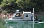 Frontier |
Childs, J.R., and Stevenson, Andrew J., 2006, Swath bathymetric survey of Englebright Lake, Yuba-Nevada Counties, California: U.S. Geological Survey Open-File Report 2006-1346, http://pubs.usgs.gov/of/2006/1346/.
| Survey Equipment | Survey Info | Data Type(s) | Data Collected |
|---|---|---|---|
| 234khz | --- | Interferometric Multibeam | File list |
| YoNav | --- | Navigation | Best file with nav in ArcInfo E00 format Global positioning system (GPS) data f-1-04-nc.060 (Provisional best file) |
| 50mhzgpr | --- | Ground Penetrating Radar | ASCII XYZ data f-1-04-nc.500_utm.csv (Provisional best file) ASCII XYZ data f-1-04-nc.500 (Provisional best file) |
| sidescansonar | --- | Sidescan |
