AKA: none
Other ID: F-1-05-TB
Status: Completed
Organization(s): USGS, Pacific Coastal and Marine Science Center
Funding Program(s): Geology of National Parks (MU119)
Principal Investigator(s): Roberto Anima, John Chin
Affiliate Investigator(s):
Information Specialist(s):
Data Type(s): Sonar: Multibeam, Location-Elevation: Navigation, Sampling: Geology
Scientific Purpose/Goals:
Vehicle(s):
Start Port/Location: Inverness, California
End Port/Location: Inverness, California
Start Date: 2005-08-15
End Date: 2005-08-16
Equipment Used: Reson Seabat 8101 Multibeam Echo Sounder, Reson Seabat 7125 Multibeam Echo Sounder, Reson Multibeam Sonar, SWATHplus 234.5 kHz, GPS, grabs
Information to be Derived: Grain size analysis, navigation, Mary McGann diatom analysis
Summary of Activity and Data Gathered: Collected 24 sediment samples labeled TB-1-24
Staff: Roberto Anima, John Chin
Affiliate Staff:
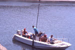
Notes: Sampling went very well, occupied nearly all pre-plotted sample sites. Samples stored in refrigerated space at the Marine Facility. Equipment descriptions: Garmin GPS, small grab sampler, 21 foot Boston Whaler
Staff information imported from InfoBank
Roberto Anima
John Chin
Location:
Tomales Bay
| Boundaries | |||
|---|---|---|---|
| North: 38.23215 | South: 38.12838 | West: -122.9802 | East: -122.87254 |
Platform(s):
 Fast Eddy (SC) |
Anima, R.L., Chin, J.L., Finlayson, D.P., McGann, M.L., and Wong, F.L., 2008, Interferometric sidescan mapping, sediment and foraminiferal analyses; a new look at Tomales Bay, California: U.S. Geological Survey Open-File Report 2008-1237, https://pubs.usgs.gov/of/2008/1237/.
| Survey Equipment | Survey Info | Data Type(s) | Data Collected |
|---|---|---|---|
| Reson Seabat 8101 Multibeam Echo Sounder | --- | Multibeam | Backscatter A [8101]--Offshore of Tomales Point, California (The acoustic-backscatter map of the Offshore of Tomales Point map area, California, was generated from backscatter data collected by California State University, Monterey Bay (CSUMB), by Fugro Pelagos, and by the U.S. Geological Survey. Mapping was completed between 2004 and 2010, using a combination of 200-kHz and 400-kHz Reson 7125, and 244-kHz Reson 8101 multibeam echosounders, as well as 234-kHz and 468-kHz SEA SWATHPlus phase-differencing sidescan sonars. These mapping missions combined to collect backscatter data from about the 10-m isobath to beyond the 3-nautical-mile limit of California's State Waters.) |
| Reson Seabat 7125 Multibeam Echo Sounder | --- | Multibeam | Backscatter B [7125]--Offshore of Tomales Point, California (The acoustic-backscatter map of the Offshore of Tomales Point map area, California, was generated from backscatter data collected by California State University, Monterey Bay (CSUMB), by Fugro Pelagos, and by the U.S. Geological Survey. Mapping was completed between 2004 and 2010, using a combination of 200-kHz and 400-kHz Reson 7125, and 244-kHz Reson 8101 multibeam echosounders, as well as 234-kHz and 468-kHz SEA SWATHPlus phase-differencing sidescan sonars. These mapping missions combined to collect backscatter data from about the 10-m isobath to beyond the 3-nautical-mile limit of California's State Waters.) |
| Reson Multibeam Sonar | --- | Multibeam | |
| SWATHplus 234.5 kHz | --- | Interferometric Multibeam | Backscatter C [Swath]--Offshore of Tomales Point, California (This part of DS 781 presents data for the acoustic-backscatter map of the Offshore of Tomales Point map area, California. Backscatter data are provided as separate grids depending on mapping system or processing method. The raster data file is included in "BackscatterC_Swath_OffshoreTomalesPoint.zip", which is accessible from https://pubs.usgs.gov/ds/781/OffshoreTomalesPoint/data_catalog_OffshoreTomalesPoint.html. These data accompany the pamphlet and map sheets of Johnson, S.Y., Dartnell, P., Golden, N.E., Hartwell, S.R., Greene, H.G., Erdey, M.D., Cochrane, G.R., Watt, J.T., Kvitek, R.G., Manson, M.W., Endris, C.A., Dieter, B.E., Krigsman, L.M., Sliter, R.W., Lowe, E.N., and Chin, J.L. (S.Y. Johnson and S.A. Cochran, eds.), 2015, California State Waters Map Series-Offshore of Tomales Point, California: U.S. Geological Survey Open-File Report 2015-1088, pamphlet 38 p., 10 sheets, scale 1:24,000, https://doi.org/10.3133/ofr20151088.
The acoustic-backscatter map of the Offshore of Tomales Point map area, California, was generated from backscatter data collected by California State University, Monterey Bay (CSUMB), by Fugro Pelagos, and by the U.S. Geological Survey. Mapping was completed between 2004 and 2010, using a combination of 200-kHz and 400-kHz Reson 7125, and 244-kHz Reson 8101 multibeam echosounders, as well as 234-kHz and 468-kHz SEA SWATHPlus phase-differencing sidescan sonars. These mapping missions combined to collect backscatter data from about the 10-m isobath to beyond the 3-nautical-mile limit of California's State Waters. Within the acoustic-backscatter imagery, brighter tones indicate higher backscatter intensity, and darker tones indicate lower backscatter intensity. The intensity represents a complex interaction between the acoustic pulse and the seafloor, as well as characteristics within the shallow subsurface, providing a general indication of seafloor texture and composition. Backscatter intensity depends on the acoustic source level, the frequency used to image the seafloor, the grazing angle, the composition and character of the seafloor, including grain size, water content, bulk density, and seafloor roughness, and some biological cover. Harder and rougher bottom types such as rocky outcrops or coarse sediment typically return stronger intensities (high backscatter, lighter tones), whereas softer bottom types such as fine sediment return weaker intensities (low backscatter, darker tones). These data are not intended for navigational purposes.) |
| GPS | --- | Navigation | Best file with nav in ArcInfo E00 format Global positioning system (GPS) data f-1-05-tb.060 (Provisional best file) |
| grabs | --- | Geology | Station Information |