AKA: none
Other ID: F-1-08-CA
Status: Completed
Organization(s): USGS, Pacific Coastal and Marine Science Center
Funding Program(s):
Principal Investigator(s): David Finlayson
Affiliate Investigator(s):
Information Specialist(s): David Finlayson
Data Type(s): Location-Elevation: Navigation, Sonar: Multibeam
Scientific Purpose/Goals:
Vehicle(s):
Start Port/Location:
End Port/Location:
Start Date: 2008-04-01
End Date: 2008-04-30
Equipment Used: GPS, SWATHplus
Information to be Derived:
Summary of Activity and Data Gathered:
Staff:
Affiliate Staff:
Notes: planned 8 days Swathplus files exist on /imgarc2/F-1-08-CA
Location:
Crystal Springs Reservoir
| Boundaries | |||
|---|---|---|---|
| North: 37.55429 | South: 37.48318 | West: -122.391 | East: -122.32231 |
Platform(s):
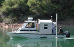 Frontier |
Finlayson, D.P., Triezenberg, Peter J., and Hart, Patrick E., 2010, Geophysical surveys of the San Andreas and Crystal Springs reservoir system including seismic-reflection profiles and swath bathymetry, San Mateo County, California: U.S. Geological Survey Open-File Report 2010-1030, http://pubs.usgs.gov/of/2010/1030/.
| Survey Equipment | Survey Info | Data Type(s) | Data Collected |
|---|---|---|---|
| GPS | --- | Navigation | Best file with nav in ArcInfo E00 format Global positioning system (GPS) data f-1-08-ca.061 (Provisional best file) |
| SWATHplus | --- | Interferometric Multibeam | File list |
