AKA: none
Other ID: F-1-09-SF
Status: Completed
Organization(s): USGS, Pacific Coastal and Marine Science Center
Funding Program(s): Shoal-channel sediment exchange (MU266)
Principal Investigator(s):
Affiliate Investigator(s):
Information Specialist(s): Jessica Lacy
Data Type(s): Location-Elevation: Navigation, Sampling: Geology, Time Series: Mooring (physical oceanography)
Scientific Purpose/Goals: Investigate mechanisms of transport of sediment from shoals to channel, and resuspension response of cohesive sediments to wind waves.
Vehicle(s):
Start Port/Location: Oyster Point
End Port/Location: Oyster Point
Start Date: 2009-02-23
End Date: 2009-03-17
Equipment Used: instrumentmooring, tripod, samples
Information to be Derived: Current speed and direction, tidal stage, wave properties, suspended sediment concentration, salinity, bed sediment grain size.
Summary of Activity and Data Gathered: Moorings to collect time-series data, and shipboard surveying and sampling during the deployment to further characterize spatial variability in currents, to collect calibration samples for optical measurements of suspended sediment concentration, and to sample bed sediment grain size.
Staff:
Affiliate Staff:
Notes: Collaboration with UC Berkeley. Platform used: Retriever (for deployment and retrieval), Frontier (for surveying and sampling).
Location:
South San Francisco Bay
| Boundaries | |||
|---|---|---|---|
| North: 37.81236071 | South: 37.43044096 | West: -122.5992 | East: -121.87542725 |
Platform(s):
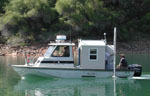 Frontier |
| Survey Equipment | Survey Info | Data Type(s) | Data Collected |
|---|---|---|---|
| instrumentmooring | --- | Geology Mooring (physical oceanography) | Station Information |
| tripod | --- | Mooring (physical oceanography) | Station Information |
| samples | --- | Biology Chemistry Geology |
