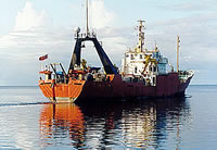
AKA: none
Other ID: F-11-90-CP,KORDI
Status: Completed
Organization(s): USGS, Pacific Coastal and Marine Science Center, Korea Ocean Research and Development Institute
Funding Program(s):
Principal Investigator(s): James Hein
Affiliate Investigator(s): Jung Ho Ahn (Kordi)
Information Specialist(s):
Data Type(s): Electro-Magnetic: Gravity, Electro-Magnetic: Magnetics, Environmental Data: Conductivity, Environmental Data: CTD, Environmental Data: Temperature, Location-Elevation: Navigation, Sampling: Chemistry, Sampling: Geology, Seismics: Air Gun / Water Gun, Seismics: Multichannel, Seismics: Sub Bottom Profiler, Sonar: Single Beam
Scientific Purpose/Goals:
Vehicle(s):
Start Port/Location: Pohnpei, FSM
End Port/Location: Pohnpei, FSM
Start Date: 1990-10-14
End Date: 1990-11-08
Equipment Used: integratednavigation, GPS, RhoRho, gravity, magnetics, 3.5khz, 10khz, airgunmonitor, 2channelairgun, CTD, chaindredge, expendablebatthermograph, Niskenbottle, tempsalinometer
Information to be Derived:
Summary of Activity and Data Gathered: physical data holdings
Staff: Michael Boyle, Henry Chezar, Kaye Kinoshita, Walt Olson, Ledabeth Pickthorn, Ransom Rideout, Jorie Schulz, Ginny Smith, Mike Wainman, Juliet Wong
Affiliate Staff:
John Cannan - Ship Captain
David Ward - Chief Engineer
Han Joon Kim (Kordi) - Geologist
Sang Ok Yoo (Kordi) - Geologist
Yong Joo (Kordi) - Mechanical Technician
Dong Won Park (Kordi) - Electronics Technician
Suk Hoon Yoon (Kordi) - Geologist
Moon Young Jung (Kordi) - Geologist
Suk Ki Kim (Kordi) - Unspecified Investigator
Aurelio Joab (FSM Representative) - Unspecified Investigator
Notes: Staff information imported from InfoBank
John Cannan - Ship Captain
David Ward - Chief Engineer
Mike Wainman - Chief Mate
Jim Hein (USGS Western Region) - Chief Scientist
Jung Ho Ahn (Kordi) - Chief Scientist
Ledabeth Pickthorn (USGS Western Region) - Navigator
Kaye Kinoshita (USGS Western Region) - Navigator
Walt Olson (USGS Western Region) - Mechanical Technician
Ransom Rideout (USGS Western Region) - Mechanical Technician
Mike Boyle (USGS Western Region) - Electronics Technician
Jorie Schulz (USGS Western Region) - Geologist
Ginny Smith (USGS Western Region) - Geologist
Juliet Wong (USGS Western Region) - Geologist
Shawn Dadisman (USGS Western Region) - Geologist
Hank Chezar (USGS Western Region) - Photographer
Han Joon Kim (Kordi) - Geologist
Sang Ok Yoo (Kordi) - Geologist
Yong Joo (Kordi) - Mechanical Technician
Dong Won Park (Kordi) - Electronics Technician
Suk Hoon Yoon (Kordi) - Geologist
Moon Young Jung (Kordi) - Geologist
Suk Ki Kim (Kordi) - Unspecified Investigator
Aurelio Joab (FSM Representative) - Unspecified Investigator
Location:
Central Pacific
| Boundaries | |||
|---|---|---|---|
| North: 11.61369 | South: 3.8993 | West: 137.4678 | East: 158.31113 |
Platform(s):
 Farnella |
Bau, M., Koschinsky, A., Dulski, P., and Hein, J.R., 1996, Comparison of the partitioning behaviours of yttrium, rare earth elements, and titanium between hydrogenetic marine ferromanganese crusts and seawater: Geochimica et Cosmochimica Acta, v. 60 no. 10, pp. 1709–1725, doi: 10.1016/0016-7037(96)00063-4.
Hein, J.R., Ahn, J.-H., Wong, J.C., Kang, J.-K., Smith, V.K., Yoon, S.-H., d'Angelo, W.M., Yoo, S.-O., Gibbs, A.E., Kim, H.-J., Quinterno, P.J., Jung, M.-Y., Davis, A.S., Park, B.-K., Gillison, J.R., Marlow, M.S., Schulz, M.S., Siems, D.F., Taggart, J.E., Jr., Rait, N., Pickthorn, L.G., Malcolm, M.J., Kavulak, M.G., Yeh, H.-W., Mann, D.M., Noble, M.A., Riddle, G.O., Roushey, B.H., and Smith, H., 1992, Geology, geophysics, geochemistry, and deep-sea mineral deposits, Federated States of Micronesia; KORDI-USGS R.V. Farnella Cruise F11-90-CP: U.S. Geological Survey Open-File Report 92-0218, 191 p., https://pubs.er.usgs.gov/publication/ofr92218.
Hein, J.R., Koschinsky, A., Halbach, P.E., Manheim, F.T., Bau, M., Kang, J.-K., and Lubick, N., 1997, Iron and manganese oxide mineralization in the Pacific, in Nicholson, Keith, Hein, James R., Buehn, Bernhard, and Dasgupta, Somnath, eds., Manganese mineralization; geochemistry and mineralogy of terrestrial and marine deposits: Geological Society Special Publications, v. 119, pp. 123–138.