AKA: none
Other ID: F-12-89-HW
Status: Completed
Organization(s):
Funding Program(s): Geological Long-Range Inclined Asdic (GLORIA) (MU116)
Principal Investigator(s): Dave Clague, Michael Torresan
Affiliate Investigator(s):
Information Specialist(s):
Data Type(s): Sonar: Sidescan, Seismics: Sub Bottom Profiler, Sonar: Single Beam, Seismics: Multichannel, Electro-Magnetic: Gravity, Electro-Magnetic: Magnetics, Location-Elevation: Navigation, Environmental Data: Conductivity, Environmental Data: Temperature
Scientific Purpose/Goals:
Vehicle(s):
Start Port/Location: Honolulu, Hawaii
End Port/Location: Honolulu, Hawaii
Start Date: 1989-11-03
End Date: 1989-11-26
Equipment Used: Gloriasidescan, 3.5khz, 10khz, 2channelairgun, gravity, magnetics, integratednavigation, GPS, RhoRho, tempsalinometer, expendablebatthermograph
Information to be Derived:
Summary of Activity and Data Gathered:
Staff:
Affiliate Staff:
Notes: Associated cruises: F-5-86-HW F-6-86-HW F-3-88-HW F-4-88-HW F-5-88-HW F-6-88-HW F-10-88-HW F-12-89-HW F-13-89-HW F-1-90-HW F-2-90-HW F-6-91-CP F-10-91-HW
Staff information imported from InfoBank
Dave Clague (USGS Western Region) - Chief Scientist
Mike Torresan (USGS Western Region) - Chief Scientist
Location:
Hawaii
| Boundaries | |||
|---|---|---|---|
| North: 27.6665 | South: 22.2664 | West: -167.2928 | East: -158.8219 |
Platform(s):
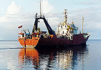
 Farnella |
Binard, N., Moore, J.G., Normark, W.R., and Holcomb, R.T., 1993, Comparison of features identified by swath-sonar mapping (GLORIA) and their 3.5 kHz echo-sounding features on the Hawaiian Ridge: American Geophysical Union Eos, Transactions, v. 74 no. 43, pp. 342–342.
Kayen, R.E., Torresan, M.E., Dadisman, S.V., Clague, D.A., Drake, D.E., Gutmacher, C.E., Hampton, M.A., Marlow, M.S., Moore, J.G., Normark, W.R., Pickthorn, L.G., Shor, S., Denlinger, R.P., Holcomb, R.T., Holmes, M.L., Lipman, P.W., Belderson, R.H., Jacobs, C., Searle, R.C., Wilson, J.B., and Rothwell, R.G., 1990, GLORIA side-scan sonar imagery of the Hawaiian Islands exclusive economic zone: American Geophysical Union Eos, Transactions, v. 71 no. 43, pp. 1580–1580.
Paskevich, V.F., Wong, F.L., O'Malley, J.J., Stevenson, A.J., and Gutmacher, C.E., 2011, GLORIA sidescan-sonar imagery for parts of the U.S. Exclusive Economic Zone and adjacent areas: U.S. Geological Survey Open-File Report 2010-1332, http://pubs.usgs.gov/of/2010/1332/.
Torresan, M.E., Clague, D.A., and Jacobs, C.L., 1991, Cruise report, Hawaiian GLORIA Cruise F12-89-HW: U.S. Geological Survey Open-File Report 91-0127, 67 p., http://pubs.usgs.gov/of/1991/0127/report.pdf.