AKA: none
Other ID: F-13-88-NC, FRNLF3-88NC, 1988-020-FA
Status: Completed
Organization(s): USGS, Pacific Coastal and Marine Science Center
Funding Program(s): Applied sediment transport (ZP009TV)
Principal Investigator(s): David Cacchione, Dave Drake
Affiliate Investigator(s):
Information Specialist(s):
Data Type(s): Environmental Data: CTD, Environmental Data: Current, Imagery: Photo, Location-Elevation: Navigation, Sampling: Geology, Sonar: Sidescan, Sonar: Single Beam, Time Series: Mooring (physical oceanography), Seismics: Sub Bottom Profiler
Scientific Purpose/Goals:
Vehicle(s):
Start Port/Location: Redwood City, CA and Redwood City, CA and Santa Cruz, CA and San Luis Obispo, CA
End Port/Location: Redwood City, CA and Santa Cruz, CA and San Luis Obispo, CA and Redwood City, CA
Start Date: 1988-12-05
End Date: 1988-12-13
Equipment Used: CTD, vectoravg, underwatercamera, DelNorte, GPS, integratednavigation, RhoRho, boxcore, gravitycore, 3.5khz, sidescansonar, Geoprobe, instrumentmooring, meters
Information to be Derived:
Summary of Activity and Data Gathered:
Staff:
Affiliate Staff:
Notes: Added Woods Hole ID 2/16/2018
Sediment Transport in Storms (STRESS). SAMPLING PT. SAL, From USGS Eastern Region admincru database... Control # --- 362 PlatformDate ID --- FRNL19881207 Sea Days --- 7 Scientists --- 19 Scientific Days --- 133 WHFC Persons --- 14 WHFC Person Days --- 98 Study Region... Northern East Coast --- N Middle East Coast --- N Southern East Coast --- N Puerto Rico --- N Gulf Coast --- N Virgin Islands --- N
Location:
Point Sal, California
| Boundaries | |||
|---|---|---|---|
| North: 38.68461 | South: 34.85722 | West: -123.529 | East: -120.71398 |
Platform(s):
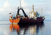
 Farnella |
| Survey Equipment | Survey Info | Data Type(s) | Data Collected |
|---|---|---|---|
| CTD | --- | Surveys (geochemical) Experiments (geochemical) CTD | Station Information |
| vectoravg | --- | Current | Station Information |
| underwatercamera | --- | Video Photo | Station Information |
| DelNorte | --- | Navigation | Survey information |
| GPS | --- | Navigation | Survey information |
| integratednavigation | --- | Navigation | Integrated navigation (SINS) data f-13-88-nc.052_degree Best file with nav in ArcInfo E00 format Integrated navigation (SINS) data f-13-88-nc.050 Integrated navigation (SINS) data.052 (Provisional best file) Survey information Lines |
| RhoRho | --- | Navigation | Survey information |
| boxcore | --- | Biology Geology | Station Information |
| gravitycore | --- | Geology | Station Information |
| 3.5khz | --- | Sub Bottom Profiler | Survey information |
| sidescansonar | --- | Sidescan | Survey information |
| Geoprobe | --- | Mooring (physical oceanography) | Station Information |
| instrumentmooring | --- | Geology Mooring (physical oceanography) | data (data in FAD) Station Information |
| meters | --- | Mooring (physical oceanography) | Station Information |