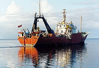
AKA: none
Other ID: F-1-89-NC, FRNL, F1-89-NC
Status: Completed
Organization(s): USGS, Pacific Coastal and Marine Science Center, USGS, Woods Hole Coastal and Marine Science Center
Funding Program(s): Exclusive Economic Zones (EEZ) (MU101)
Principal Investigator(s): John Chin, Dave Rubin
Affiliate Investigator(s):
Information Specialist(s): John Chin, Dave Rubin
Data Type(s): Electro-Magnetic: Gravity, Imagery: Video, Location-Elevation: Navigation, Sampling: Geology, Seismics: Boomer, Seismics: Sub Bottom Profiler, Sonar: Sidescan, Sonar: Single Beam
Scientific Purpose/Goals: The objectives of cruises 89001 and 89002 were to obtain a baseline data set of high-resolution sidescan-sonar imagery, single-channel geophysical profiles (high resolution) of the shallow subbottom, intermediate-penetration 40 cubic inch airgun profiles, and the surface sediment samples. The baseline data set was designed to allow us to characterize and understand this shallow segment of the continental margin off San Francisco, and to serve as a preliminary database for subsequent, more detailed and site specific studies.
Vehicle(s):
Start Port/Location: Redwood City, CA
End Port/Location: San Francisco, CA
Start Date: 1989-01-06
End Date: 1989-01-11
Equipment Used: Huntec, sidescansonar, uniboom, 3.5khz, VHS, gravity, rangerange, GPS, RhoRho, 10khz, VanVeengrab
Information to be Derived:
Summary of Activity and Data Gathered:
Staff: J. Amarena, Jon Erickson, Larry Kooker, Dennis Mann, Ledabeth Pickthorn, Lisa Webber
Affiliate Staff:
John Cannon (Farnella) - Captain
J. Marr (Farnella) - Captain
Dave Twichell (USGS Woods Hole) - Unspecified
Dave Nichols (USGS Woods Hole) - Unspecified
Tom O'Brien (USGS Woods Hole) - Unspecified
M. Sheridan (USGS) - Volunteer
Notes: Farallons surveys, Huntec side scan
Staff information imported from InfoBank
Dave Rubin (USGS Western Region) - Chief Scientist
John Chin (USGS Western Region) - Chief Scientist
John Cannon (Farnella) - Captain
J. Marr (Farnella) - Captain
Dave Twichell (USGS Woods Hole) - Unspecified
Lisa Webber (USGS Woods Hole) - Unspecified
Dave Nichols (USGS Woods Hole) - Unspecified
Larry Kooker (USGS Woods Hole) - Unspecified
Tom O'Brien (USGS Woods Hole) - Unspecified
Jon Erickson (USGS Woods Hole) - Unspecified
Dennis Mann (USGS Western Region) - Unspecified
J. Amarena (USGS) - Volunteer
M. Sheridan (USGS) - Volunteer
Ledabeth Pickthorn (USGS Western Region) - Unspecified
Location:
Northern California
| Boundaries | |||
|---|---|---|---|
| North: 38.06013 | South: 37.40781 | West: -123.4159 | East: -122.19586 |
Platform(s):
 Farnella |