AKA: none
Other ID: F-2-06-MB
Status: Completed
Organization(s): USGS, Pacific Coastal and Marine Science Center
Funding Program(s): Pleasure Point (MU230), Coastal Change Hazards (MU051)
Principal Investigator(s): Curt Storlazzi
Affiliate Investigator(s):
Information Specialist(s): Joshua Logan
Data Type(s): Time Series: Mooring (physical oceanography)
Scientific Purpose/Goals: measure waves, currents and tides
Vehicle(s):
Start Port/Location: Santa Cruz small craft harbor
End Port/Location: Santa Cruz small craft harbor
Start Date: 2006-08-21
End Date: 2006-08-24
Equipment Used: AWAC
Information to be Derived: waves, currents and tides
Summary of Activity and Data Gathered:
Staff: Curt Storlazzi, Joshua Logan, Kathy Presto
Affiliate Staff:
Notes: Associated field activities: P-1-05-MB W-1-05-MB F-1-06-MB F-2-06-MB F-3-06-MB P-1-06-MB P-P1-06-MB F-1-07-MB P-1-07-MB
Staff information imported from InfoBank
Curt Storlazzi
Josh Logan
Kathy Presto
Location:
northern Monterey Bay
| Boundaries | |||
|---|---|---|---|
| North: 37 | South: 36.75 | West: -122.5 | East: -121.75 |
Platform(s):
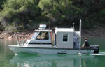 Frontier |
Storlazzi, C.D., Barnard, P.L., Collins, B.D., Finlayson, D.P., Golden, N.E., Hatcher, G.A., Kayen, R.E., and Ruggiero, P., 2007, High-resolution topographic, bathymetric, and oceanographic data for the Pleasure Point area, Santa Cruz County, California; 2005-2007: U.S. Geological Survey Open-File Report 2007-1270, 23 p., http://pubs.usgs.gov/of/2007/1270/.
| Survey Equipment | Survey Info | Data Type(s) | Data Collected |
|---|---|---|---|
| AWAC | --- | Mooring (physical oceanography) |
