AKA: none
Other ID: F-2-08-MB
Status: Completed
Organization(s): USGS, Pacific Coastal and Marine Science Center
Funding Program(s): National Seafloor Mapping and Benthic Habitat Studies (MU195)
Principal Investigator(s): Christopher Conaway, Curt Storlazzi
Affiliate Investigator(s):
Information Specialist(s): Curt Storlazzi
Data Type(s): Environmental Data: Conductivity, Environmental Data: Temperature, Sampling: Geology
Scientific Purpose/Goals: Collect oceanographic data and suspended sediment samples to understand influence of storms and floods on nearshore ecosystems
Vehicle(s):
Start Port/Location: Santa Cruz Harbor
End Port/Location: Santa Cruz Harbor
Start Date: 2008-12-10
End Date: 2008-12-10
Equipment Used: tempsalinometer, sedimenttrap
Information to be Derived: temperature, salinity, sediment grain size, sediment composition, sediment geochemistry
Summary of Activity and Data Gathered:
Staff: Curt Storlazzi, Joshua Logan, Jackson Currie
Affiliate Staff:
Notes: Related activites: P-2-08-MB P-2-08-MB sediment trap and oceanographic instrument recovery and redeployment
Staff information imported from InfoBank
Curt Storlazzi (diver, USGS, PSC) - chief scientist
Christopher Conaway (chief scientist, USGS, PSC) - co
Josh Logan (diver, USGS, PSC) - vessel captain
Jackson Currie (USGS, PSC) - mechanical technician
Location:
Monterey Bay
| Boundaries | |||
|---|---|---|---|
| North: 37 | South: 36.75 | West: -122.5 | East: -121.75 |
Platform(s):
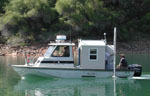 Frontier |
| Survey Equipment | Survey Info | Data Type(s) | Data Collected |
|---|---|---|---|
| tempsalinometer | --- | Conductivity Temperature | |
| sedimenttrap | --- | Geology |
