AKA: none
Other ID: F-2-84-NC,F284COW
Status: Completed
Organization(s):
Funding Program(s): Geological Long-Range Inclined Asdic (GLORIA) (MU116)
Principal Investigator(s): Jim Gardner, Dave McCulloch
Affiliate Investigator(s):
Information Specialist(s):
Data Type(s): Electro-Magnetic: Magnetics, Location-Elevation: Navigation, Seismics: Air Gun / Water Gun, Seismics: Multichannel, Seismics: Sub Bottom Profiler, Sonar: Sidescan
Scientific Purpose/Goals:
Vehicle(s):
Start Port/Location: Long Beach, CA
End Port/Location: San Francisco, CA
Start Date: 1984-05-23
End Date: 1984-06-13
Equipment Used: transitsatellite, 3.5khz, magnetics, 2channelairgun, sidescansonar, LoranC, airgun
Information to be Derived:
Summary of Activity and Data Gathered:
Staff:
Affiliate Staff:
Notes: Associated cruises: F-1-84-SC F-2-84-NC F-3-84-NC F-4-84-WO
Staff information imported from InfoBank
Jim Gardner (USGS Western Region) - Chief Scientist
Dave McCulloch (USGS Western Region) - Chief Scientist
Location:
Northern California
| Boundaries | |||
|---|---|---|---|
| North: 41.75 | South: 33.75 | West: -127.75 | East: -118.25 |
Platform(s):
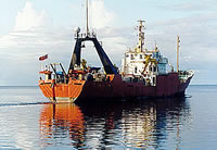
 Farnella |
EEZ-SCAN 84 Scientific Staff,, 1985, MV Farnella cruises 1/84 to 4/84, 26 April to 15 August 1984; GLORIA studies of the Exclusive Economic Zone off the western United States between 30 degrees 30' and 48 degrees 30' N: U.S. Geological Survey Open-File Report 85-508, http://pubs.er.usgs.gov/usgspubs/ofr/ofr85508.
Fildani, A., Normark, W.R., 2004, Late Quaternary evolution of channel and lobe complexes of Monterey Fan: Marine Geology, v. 206 no. 1-4, pp. 199–223, doi: 10.1016/j.margeo.2004.03.001.
Gardner, J.V., Cacchione, D.A., Drake, D.E., Edwards, B.D., Field, M.E., Hampton, M.A., Karl, H.A., Kenyon, N.H., Masson, D.G., McCulloch, D.S., and Grim, M.S., 1993, Map showing depth to basement in the deep-sea basins of the Pacific continental margin, Cape Mendocino to Point Conception: U.S. Geological Survey Miscellaneous Investigations Series Map I-2090-B, https://pubs.usgs.gov/imap/2090/b/.
Gardner, J.V., Cacchione, D.A., Drake, D.E., Edwards, B.D., Field, M.E., Hampton, M.A., Karl, H.A., Kenyon, N.H., Masson, D.G., McCulloch, D.S., and Grim, M.S., 1993, Map showing sediment isopachs in the deep-sea basins of the Pacific continental margin, Cape Mendocino to Point Conception: U.S. Geological Survey Miscellaneous Investigations Series Map I-2090-A, https://pubs.usgs.gov/imap/2090/a/.
Paskevich, V.F., Wong, F.L., O'Malley, J.J., Stevenson, A.J., and Gutmacher, C.E., 2011, GLORIA sidescan-sonar imagery for parts of the U.S. Exclusive Economic Zone and adjacent areas: U.S. Geological Survey Open-File Report 2010-1332, http://pubs.usgs.gov/of/2010/1332/.
Steele, W.C., Degnan, C.H., Deeter, G.B., and Riordan, J.A., 1989, Description of marine geophysical data collected by the U.S. Geological Survey and how to obtain it: U.S. Geological Survey Open-File Report 89-167, 26 p., https://pubs.er.usgs.gov/publication/ofr89167.
Wolf, S., and Gutmacher, C., 2004, Geologic and Bathymetric Reconnaissance Overview of the San Pedro Shelf Region, Southern California: U.S. Geological Survey Open-File Report 2004-1049, http://pubs.usgs.gov/of/2004/1049/.
Wong, F.L., and Grim, M.S., 2015, Depth-to-basement, sediment-thickness, and bathymetry data for the deep-sea basins offshore of Washington, Oregon, and California: U.S. Geological Survey Open-File Report 2015-1118, 17 p.