AKA: none
Other ID: F-2-88-HW
Status: Completed
Organization(s):
Funding Program(s):
Principal Investigator(s): Dave Clague
Affiliate Investigator(s):
Information Specialist(s):
Data Type(s): Electro-Magnetic: Magnetics, Imagery: Photo, Imagery: Video, Location-Elevation: Navigation, Sampling: Biology, Sampling: Geology, Seismics: Sub Bottom Profiler, Sonar: Single Beam
Scientific Purpose/Goals:
Vehicle(s):
Start Port/Location: Hilo, HI
End Port/Location: Hilo, HI
Start Date: 1988-02-25
End Date: 1988-03-09
Equipment Used: RhoRho, 10khz, 3.5khz, boxcore, chaindredge, underwatercamera, underwatertelevision, gradiometer, GPS, integratednavigation
Information to be Derived:
Summary of Activity and Data Gathered:
Staff:
Affiliate Staff:
Notes:
Staff information imported from InfoBank
Dave Clague (USGS Western Region) - Chief Scientist
Location:
Hawaii
| Boundaries | |||
|---|---|---|---|
| North: 20.68586 | South: 16.1607 | West: -156.697 | East: -154.15257 |
Platform(s):
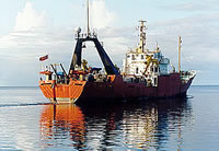
 Farnella |
Adamczyk, K., Mizell, K., Payan, D., Dominguez, N.O., Oliva, L., and Gartman, A., 2023, Marine mineral geochemical data - Part One: Pacific Ocean USGS-affiliated historical data: U.S. Geological Survey data release, https://doi.org/10.5066/P9GD1JKB.
Chezar, H., and Newman, I., 2006, Overview: DVD-video disc set of seafloor transects during USGS research cruises in the Pacific Ocean: U.S. Geological Survey Open-File Report 2004-1101, https://pubs.usgs.gov/of/2004/1101/.
Chezar, H., and Newman, Ivy, 2004, DVD-Video Disc set of seafloor transects during USGS research cruises in the Pacific Ocean: U.S. Geological Survey Open-File Report 2004-1147.
Chezar, H., and Newman, Ivy, 2004, DVD-Video Disc set of seafloor transects during USGS research cruises in the Pacific Ocean: U.S. Geological Survey Open-File Report 2004-1148.
Chezar, H., and Newman, Ivy, 2004, DVD-Video Disc set of seafloor transects during USGS research cruises in the Pacific Ocean: U.S. Geological Survey Open-File Report 2004-1149.
Clague, D.A., Moore, J.G., Torresan, M.E., Holcomb, R.T., and Lipman, P.W., 1988, Shipboard report for Hawaii GLORIA ground-truth Cruise F2-88-HW, 25 Feb.-9 March, 1988: U.S. Geological Survey Open-File Report 88-0292, 58 p.
Hein, J.R., Koschinsky, A., Halbach, P.E., Manheim, F.T., Bau, M., Kang, J.-K., and Lubick, N., 1997, Iron and manganese oxide mineralization in the Pacific, in Nicholson, Keith, Hein, James R., Buehn, Bernhard, and Dasgupta, Somnath, eds., Manganese mineralization; geochemistry and mineralogy of terrestrial and marine deposits: Geological Society Special Publications, v. 119, pp. 123–138.
Moore, J.G., and Normark, W.R.,, 1990, Significance of major landslides on the Hawaiian Ridge: American Association of Petroleum Geologists Bulletin, v. 74 no. 6, pp. 991–992.
FAN F288HW has data viewable in the CMGP Video and Photograph Portal. View the data in this application here. See the instructions for working with this application.