AKA: none
Other ID: F-2-95-NC
Status: Completed
Organization(s): USGS, Pacific Coastal and Marine Science Center
Funding Program(s): Crustal Earthquake Hazards (MU077)
Principal Investigator(s): Sam Clarke, Andy Stevenson
Affiliate Investigator(s):
Information Specialist(s):
Data Type(s): Location-Elevation: Navigation, Seismics: Boomer, Seismics: Sub Bottom Profiler, Sonar: Single Beam
Scientific Purpose/Goals: To obtain evidence of faulting and other coseismic deformation from lagoonal sediments in water bodies developed on the lower plates of thrust faults in an active forearc thrust belt. Data will be used to locate core sites for follow-on coring program to date fault offset and determine deformation rates.
Vehicle(s):
Start Port/Location:
End Port/Location:
Start Date: 1995-09-27
End Date: 1995-09-29
Equipment Used: 7khz, 200khz, pcode, Geopulse
Information to be Derived: High-resolution seismic reflection data from upper 10-30 m of sedimentary section. Seismic reflection profiles with interpretation; possibly, bathymetric maps of the lagoons.
Summary of Activity and Data Gathered: Successful in Big and Stone Lagoons, with 1/8 and 1/4 sec Geopulse, 1/8 sec 700 kHz, and 200 kHz fathometer data obtained both. Minor problems with GPS locations. Water level in Lake Earl was too low (~4 MSL) to permit launch of Fast Eddy at available launch sites. Plan to return to Lake Earl when lake level is greater than ~6 ft MSL.
Staff:
Affiliate Staff:
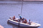
Notes: Analog records from the systems employed. The seemingly annual end-of-the-fiscal-year fun in northern California-Oregon this year involved collection of high-resolution seismic data from Big Lagoon and Stone Lagoon north of Eureka, California. The crew of Sam Clarke, Andy Stevenson, and Dave Hogg aboard "Fast" Eddy collected 40 lines of Geopulse, 7kHz, and 200 Khz data from the lagoons, seeking evidence of faulting and coseismic deformation from the lower plates of thrust faults in an active forearc thrust system. We hope that this information will ultimately contribute to knowledge of earthquake recurrence intervals and magnitudes. There were some difficulties with P-code GPS locations, and interpretation remains, but the data look good and should provide bonus information on processes related to flushing and filling of the lagoons. The water level in Lake Earl, near Crescent City, was too low to launch Eddy, so we missed one target. Great weather (mostly), elk herds, river otter, and a brief road race with a black bear -- geology at its best.
Staff information imported from InfoBank
Sam Clarke (USGS Western Region) - Chief Scientist
Andy Stevenson (USGS Western Region) - Chief Scientist
Location:
Stone Lagoon - Northern California
| Boundaries | |||
|---|---|---|---|
| North: 41.75 | South: 37.75 | West: -125.75 | East: -122.25 |
Platform(s):
 Fast Eddy (SC) |
| Survey Equipment | Survey Info | Data Type(s) | Data Collected |
|---|---|---|---|
| 7khz | --- | Sub Bottom Profiler | |
| 200khz | --- | Single Beam | |
| pcode | --- | Navigation | |
| Geopulse | --- | Boomer |