AKA: none
Other ID: F-3-07-NC
Status: Completed
Organization(s): USGS, Pacific Coastal and Marine Science Center
Funding Program(s):
Principal Investigator(s): Brian Edwards
Affiliate Investigator(s):
Information Specialist(s):
Data Type(s): Imagery: Photo, Imagery: Video, Location-Elevation: Navigation
Scientific Purpose/Goals:
Vehicle(s):
Start Port/Location: Princeton Harbor
End Port/Location: Bodega Bay Harbor
Start Date: 2007-09-27
End Date: 2007-10-11
Equipment Used: underwatervideo, camera, GPS
Information to be Derived: video and imagery
Summary of Activity and Data Gathered:
Staff:
Affiliate Staff:
Notes: Non USGS data manager = Eleyne Phillips
Location:
Offshore central California
| Boundaries | |||
|---|---|---|---|
| North: 38.35269 | South: 36.42513 | West: -123.522 | East: -121.88771 |
Platform(s):
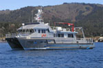 Fulmar |
Cochrane, G.R., Dartnell, P., Johnson, S.Y., Erdey, M.D., Golden, N.E., Greene, H.G., Dieter, B.E., Hartwell, S.R., Ritchie, A.C., Finlayson, D.P., Endris, C.A., Watt, J.T., Davenport, C.W., Sliter, R.W., Maier, K.L., and Krigsman, L.M., 2016, California State Waters Map SeriesâOffshore of Santa Cruz, California: In: Cochrane, G.R., and Cochran, S.A. (Eds.). U.S. Geological Survey Open-File Report 2016-1024, http://pubs.er.usgs.gov/publication/ofr20161024.
Cochrane, G.R., Watt, J.T., Dartnell, P., Greene, H.G., Erdey, M.D., Dieter, B.E., Golden, N.E., Johnson, S.Y., Endris, C.A., Hartwell, S.R., Kvitek, R.G., Davenport, C.W., Krigsman, L.M., Ritchie, A.C., Sliter, R.W., Finlayson, D.P., and Maier, K.L., 2015, California State Waters Map SeriesâOffshore of Pigeon Point, California: In: Cochrane, G.R., Cochran, S.A. (Eds.). U.S. Geological Survey Open-File Report 2015-1232.
Edwards, B.D., Phillips, E.L., Dartnell, P., Greene, H.G., Bretz, C.K., Kvitek, R.G., Hartwell, S.R., Johnson, S.Y., Cochrane, G.R., Dieter, B.E., Sliter, R.W., Ross, S.L., Golden, N.E., Watt, J.T., Chin, J.L., Erdey, M.D., Krigsman, L.M., Manson, M.W., and Endris, C.A., 2015, California State Waters Map SeriesâOffshore of Pacifica, California: In: Cochran, S.A., and Edwards, B.D. (Eds.). U.S. Geological Survey Open-File Report 2014-1260, 38 p.
FAN F307NC has data viewable in the CMGP Video and Photograph Portal. View the data in this application here. See the instructions for working with this application.
| Survey Equipment | Survey Info | Data Type(s) | Data Collected |
|---|---|---|---|
| underwatervideo | --- | Video | Habitat--Offshore of Half Moon Bay, California (This part of DS 781 presents data for the habitat map of the seafloor of the Offshore of Half Moon Bay map area, California. The polygon shapefile is included in ""Habitat_OffshoreHalfMoonBay.zip,"" which is accessible from https://pubs.usgs.gov/ds/781/OffshoreHalfMoonBay/data_catalog_OffshoreHalfMoonBay.html. These data accompany the pamphlet and map sheets of Cochrane, G.R., Dartnell, P., Greene, H.G., Johnson, S.Y., Golden, N.E., Hartwell, S.R., Dieter, B.E., Manson, M.W., Sliter, R.W., Ross, S.L., Watt, J.T., Endris, C.A., Kvitek, R.G., Phillips, E.L., Erdey, M.D., Chin, J.L., and Bretz, C.K. (G.R. Cochrane and S.A. Cochran, eds.), 2014, California State Waters Map Series--Offshore of Half Moon Bay, California: U.S. Geological Survey Open-File Report 2014-1214, pamphlet 37 p., 10 sheets, scale 1:24,000, https://doi.org/10.3133/ofr20141214.
Potential marine benthic habitat maps were constructed using multibeam echosounder (MBES) bathymetry and backscatter data. The habitats were based on substrate types and documented or ""ground truthed"" using underwater video images and seafloor samples obtained by the USGS. These maps display various habitat types that range from flat, soft, unconsolidated sediment-covered seafloor to hard, deformed (folded), or highly rugose and differentially eroded bedrock exposures.) Seafloor character--Offshore of Half Moon Bay, California (This part of DS 781 presents the seafloor-character map of the Offshore of Half Moon Bay map area, California. The raster data file is included in ""SeafloorCharacter_OffshoreHalfMoonBay.zip"", which is accessible from https://pubs.usgs.gov/ds/781/OffshoreHalfMoonBay/data_catalog_OffshoreHalfMoonBay.html. This raster-format seafloor-character map shows four substrate classes of Offshore of Half Moon Bay, California. These data accompany the pamphlet and map sheets of Cochrane, G.R., Dartnell, P., Greene, H.G., Johnson, S.Y., Golden, N.E., Hartwell, S.R., Dieter, B.E., Manson, M.W., Sliter, R.W., Ross, S.L., Watt, J.T., Endris, C.A., Kvitek, R.G., Phillips, E.L., Erdey, M.D., Chin, J.L., and Bretz, C.K. (G.R. Cochrane and S.A. Cochran, eds.), 2014, California State Waters Map Series--Offshore of Half Moon Bay, California: U.S. Geological Survey Open-File Report 2014-1214, pamphlet 37 p., 10 sheets, scale 1:24,000, https://doi.org/10.3133/ofr20141214. This raster-format seafloor-character map shows four substrate classes in the Offshore of Half Moon Bay map area. The substrate classes mapped in this area have been further divided into the following California Marine Life Protection Act depth zones and slope classes: Depth Zone 2 (intertidal to 30 m), Depth Zone 3 (30 to 100 m), and Slope Class 1 (0 degrees - 5 degrees). Depth Zone 1 (intertidal), Depth Zones 4-5 (greater than 100 m), and Slopes Classes 2-4 (greater than 5 degrees) are not present in the region covered by this block. The map is created using a supervised classification method described by Cochrane (2008). References Cited: California Department of Fish and Game, 2008, California Marine Life Protection Act master plan for marine protected areas, Revised draft: California Department of Fish and Game, accessed April 5 2011, at http://www.dfg.ca.gov/mlpa/masterplan.asp. Cochrane, G.R., 2008, Video-supervised classification of sonar data for mapping seafloor habitat, in Reynolds, J.R., and Greene, H.G., eds., Marine habitat mapping technology for Alaska: Fairbanks, University of Alaska, Alaska Sea Grant College Program, p. 185-194, accessed April 5, 2011, at http://doc.nprb.org/web/research/research%20pubs/615_habitat_mapping_workshop/Individual%20Chapters%20High-Res/Ch13%20Cochrane.pdf. Sappington, J.M., Longshore, K.M., and Thompson, D.B., 2007, Quantifying landscape ruggedness for animal habitat analysis--A case study using bighorn sheep in the Mojave Desert: Journal of Wildlife Management, v. 71, p. 1419-1426.) Habitat--Offshore of San Gregorio, California (This part of SIM 3306 presents data for the habitat map of the Offshore of San Gregorio map area, California. The vector data file is included in ""Habitat_OffshoreSanGregorio.zip,"" which is accessible from https://pubs.usgs.gov/ds/781/OffshoreSanGregorio/data_catalog_OffshoreSanGregorio.html. These data accompany the pamphlet and map sheets of Cochrane, G.R., Dartnell, P., Greene, H.G., Watt, J.T., Golden, N.E., Endris, C.A., Phillips, E.L., Hartwell, S.R., Johnson, S.Y., Kvitek, R.G., Erdey, M.D., Bretz, C.K., Manson, M.W., Sliter, R.W., Ross, S.L., Dieter, B.E., and Chin, J.L. (G.R. Cochrane and S.A. Cochran, eds.), 2014, California State Waters Map Series--Offshore of San Gregorio, California: U.S. Geological Survey Scientific Investigations Map 3306, pamphlet 38 p., 10 sheets, scale 1:24,000, https://doi.org/10.3133/sim3306. Potential marine benthic habitat maps were constructed using multibeam echosounder (MBES) bathymetry and backscatter data. The habitats were based on substrate types and documented or ""ground truthed"" using underwater video images and seafloor samples obtained by the USGS. These maps display various habitat types that range from flat, soft, unconsolidated sediment-covered seafloor to hard, deformed (folded), or highly rugose and differentially eroded bedrock exposures.) Seafloor character--Offshore of San Gregorio, California (This part of SIM 3306 presents data for the seafloor-character map of the Offshore of San Gregorio map area, California. The raster data file is included in ""SeafloorCharacter_OffshoreSanGregorio.zip,"" which is accessible from https://pubs.usgs.gov/ds/781/OffshoreSanGregorio/data_catalog_OffshoreSanGregorio.html. These data accompany the pamphlet and map sheets of Cochrane, G.R., Dartnell, P., Greene, H.G., Watt, J.T., Golden, N.E., Endris, C.A., Phillips, E.L., Hartwell, S.R., Johnson, S.Y., Kvitek, R.G., Erdey, M.D., Bretz, C.K., Manson, M.W., Sliter, R.W., Ross, S.L., Dieter, B.E., and Chin, J.L. (G.R. Cochrane and S.A. Cochran, eds.), 2014, California State Waters Map Series--Offshore of San Gregorio, California: U.S. Geological Survey Scientific Investigations Map 3306, pamphlet 38 p., 10 sheets, scale 1:24,000, https://doi.org/10.3133/sim3306. This raster-format seafloor-character map shows four substrate classes in the Offshore of San Gregorio map area. The substrate classes mapped in this area have been colored to indicate which of the following California Marine Life Protection Act depth zones and slope classes they belong: Depth Zone 2 (intertidal to 30 m), Depth Zone 3 (30 to 100 m), and Slope Class 1 (0 degrees - 5 degrees). Depth Zones 1 (intertidal) and 4 to 5 (greater than 100 m), as well as Slopes Classes 2 to 4 (greater than 5 degrees), are not present in this map area. The map is created using a supervised classification method described by Cochrane (2008). References Cited: California Department of Fish and Game, 2008, California Marine Life Protection Act master plan for marine protected areas--Revised draft: California Department of Fish and Game, accessed April 5 2011, at http://www.dfg.ca.gov/mlpa/masterplan.asp. Cochrane, G.R., 2008, Video-supervised classification of sonar data for mapping seafloor habitat, in Reynolds, J.R., and Greene, H.G., eds., Marine habitat mapping technology for Alaska: Fairbanks, University of Alaska, Alaska Sea Grant College Program, p. 185-194, accessed April 5, 2011, at http://doc.nprb.org/web/research/research%20pubs/615_habitat_mapping_workshop/Individual%20Chapters%20High-Res/Ch13%20Cochrane.pdf. Sappington, J.M., Longshore, K.M., and Thompson, D.B., 2007, Quantifying landscape ruggedness for animal habitat analysis--A case study using bighorn sheep in the Mojave Desert: Journal of Wildlife Management, v. 71, p. 1419-1426.) F307NC_video_observations (This part of DS 781 presents video observations from cruise F307NC in northern California The vector data file is included in ""f307nc_video_observations.zip,"" which is accessible from https://pubs.usgs.gov/ds/781/video_observations/data_catalog_video_observations.html. Between 2006 and 2007, the seafloor in northern California was mapped by California State University, Monterey Bay, Seafloor Mapping Lab (CSUMB) and by the U.S. Geological Survey (USGS), using both multibeam echosounders and bathymetric sidescan sonar units. These mapping missions combined to collect bathymetry and acoustic-backscatter data from about the 10-m isobath to out beyond the 3-nautical-mile limit of California's State Waters. To validate the interpretations of sonar data in order to turn it into geologically and biologically useful information, the USGS ground-truth surveyed the data by towing camera sleds over specific locations throughout the region. During the 2007 ground-truth cruise, the camera sled housed two video cameras (one forward looking and the other vertical looking), a high-definition video camera, and an 8-megapixel digital still camera. The video was fed in real time to the research vessel, where USGS and NOAA scientists recorded both the geologic and biologic character of the seafloor into programmable keypads once every minute. In addition to recording the seafloor characteristics, a digital still photograph was captured once every 30 seconds. This ArcGIS shape file includes the position of the camera, the time each observation was started, and the visual observations of geologic and biologic habitat.) |
| camera | --- | Photo | |
| GPS | --- | Navigation | Global positioning system (GPS) data f-3-07-nc.063_ship Global positioning system (GPS) data f-3-07-nc.064 Global positioning system (GPS) data f-3-07-nc.061_ship Global positioning system (GPS) data f-3-07-nc.060 Global positioning system (GPS) data f-3-07-nc.061_garmin Global positioning system (GPS) data f-3-07-nc.061_garmin_naut Global positioning system (GPS) data f-3-07-nc.061_garmin_naut_course Global positioning system (GPS) data f-3-07-nc.060_ship Best file with nav in ArcInfo E00 format Global positioning system (GPS) data f-3-07-nc.060_garmin Global positioning system (GPS) data f-3-07-nc.062_ship Global positioning system (GPS) data f-3-07-nc.062_ship_naut Global positioning system (GPS) data f-3-07-nc.062_ship_naut_course Global positioning system (GPS) data f-3-07-nc.063_fish Global positioning system (GPS) data f-3-07-nc.064_ship Global positioning system (GPS) data f-3-07-nc.065 (Provisional best file) |
