AKA: none
Other ID: F-3-92-SC
Status: Completed
Organization(s):
Funding Program(s): Palos Verdes Mapping (MU227)
Principal Investigator(s): Monty Hampton, Herman Karl
Affiliate Investigator(s):
Information Specialist(s):
Data Type(s): Location-Elevation: Navigation, Seismics: Sub Bottom Profiler, Sonar: Sidescan, Sonar: Single Beam
Scientific Purpose/Goals:
Vehicle(s):
Start Port/Location:
End Port/Location:
Start Date: 1992-04-22
End Date: 1992-05-15
Equipment Used: 3.5khz, GPS, 10khz, Gloriasidescan
Information to be Derived:
Summary of Activity and Data Gathered:
Staff: Jeff Anderson, Willy Angus, Michael Boyle, Tom Chase, Pat Chavez, John Chin, Joseph Coddington, Brian Edwards, Greg Gabel, John Gann, Michael Hamer, Gerry Hatcher, Larry Kooker, Homa Lee, Norman Maher, Dennis Mann, Larry Mayer, Mark McLaughlin, Ransom Rideout, Stuart Sides, Michael Torresan, Jim Vaughan, Steve Wessels, Hal Williams
Affiliate Staff:
John Nichols (J. Marr) - Ship Captain
Terry Chantler (J. Marr) - Chief Mate
Shannon Byrne (URI
nav
) - Computer Analyst
Sheffield Corey (URI
nav
) - Computer Analyst
Paul Hague (Datasonics) - Computer Operator
Brian Wilson (Datasonics) - Computer Operator
Bob Tice (URI) - Computer Analyst
Steve Howe (ODEC) - Computer Analyst
Bob Tarini (ODEC) - Computer Analyst
Notes: Staff information imported from InfoBank
John Nichols (J. Marr) - Ship Captain
Terry Chantler (J. Marr) - Chief Mate
Willy Angus (J. Marr) - Chief Engineer
Herman Karl (USGS Western Region) - Chief Scientist
Monty Hampton (USGS Western Region) - Chief Scientist
Jeff Anderson (USGS Western Region, flagst, ) - Computer Analyst
Michael Boyle (USGS Western Region) - Electronics Technician
Shannon Byrne (URI, nav, ) - Computer Analyst
Tom Chase (USGS Western Region) - Geologist
John Chin (USGS Western Region) - Geologist
Joseph Coddington (USGS Western Region) - Computer Analyst
Sheffield Corey (URI, nav, ) - Computer Analyst
Greg Gabel (USGS Western Region) - Computer Analyst
John Gann (USGS Western Region) - Computer Analyst
Paul Hague (Datasonics) - Computer Operator
Michael Hamer (USGS Western Region, facs Curator, ) - Computer Analyst
Gerry Hatcher (URI, nav, ) - Computer Analyst
Larry Kooker (USGS Western Region) - Electronics Technician
Homa Lee (USGS Western Region) - Geologist
Norman Maher (USGS Western Region) - Geologist
Dennis Mann (USGS Western Region) - Computer Analyst
Larry Mayer (USGS Western Region) - Computer Operator
Mark McLaughlin (USGS Western Region) - Geologist
Ransom Rideout (USGS Western Region) - Mechanical Technician
Mike Torresan (USGS Western Region) - Geologist
Brian Wilson (Datasonics) - Computer Operator
Pat Chavez (USGS Western Region, flagst, ) - Computer Analyst
Bob Tice (URI) - Computer Analyst
Stuart Sides (USGS Flagstaff) - Computer Analyst
Steve Wessels (USGS Western Region) - Photographer
Hal Williams (USGS Western Region) - Mechanical Technician
Jim Vaughan (USGS Western Region) - Electronics Technician
Brian Edwards (USGS Western Region) - Geologist
Steve Howe (ODEC) - Computer Analyst
Bob Tarini (ODEC) - Computer Analyst
Location:
Southern California
| Boundaries | |||
|---|---|---|---|
| North: 37.5024 | South: 33.51704 | West: -122.651 | East: -118.21689 |
Platform(s):
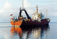
 Farnella |
Lee, H.J., Drake, D.E., Edwards, B.D., Hamer, M.R., Hampton, M.A., Karl, H.A., Kayen, R.E., and Wong, F.L., 1995, Mapping the distribution and character of contaminated sediment on the continental margin near Los Angeles, California, in Linked Earth systems: congress program and abstracts; v. 1: Tulsa, OK, Society of Economic Paleontologists and Mineralogists.
Lee, H.J., Drake, D.E., Edwards, B.D., Hamer, M.R., Hampton, M.A., Karl, H.A., Kayen, R.E., Wong, F.L., and Murray, C.J., 1996, Contaminated, Effluent-Affected Sediment on the Continental Margin near Los Angeles, California: EOS Trans. AGU, 76(3), Ocean Sciences Meeting Supplement OS1, 1996.
Murray, C.J., Lee, H.J., and Hampton, M.A., 1996, Probabilistic mapping of the thickness of contaminated sediment, Palos Verdes margin, Southern California: American Geophysical Union Eos, Transactions, v. 77 no. 3, pp. 50–50.
Schreppel, H.A., Degnan, C.H, Dadisman, S.V., and Metzger, D.R., 2013, Archive of U.S. Geological Survey Selected Single-Beam Bathymetry Datasets, 1969â2000: U.S. Geological Survey Data Series 757, http://pubs.usgs.gov/ds/757/.
Wong, F.L., 1996, Heavy Mineralogy of Effluent-Affected Sediment, Palos Verdes, Southern California: EOS Transactions, v. 77 no. 3, pp. 50–50.
| Survey Equipment | Survey Info | Data Type(s) | Data Collected |
|---|---|---|---|
| 3.5khz | --- | Sub Bottom Profiler | Survey information |
| GPS | --- | Navigation | Best file with nav in ArcInfo E00 format Lines Global positioning system (GPS) data f-3-92-sc.062 (Provisional best file) Global positioning system (GPS) data f-3-92-sc.062_degree |
| 10khz | --- | Single Beam | Raw depth (bathymetry) data f-3-92-sc.301 Raw depth (bathymetry) data f-3-92-sc.301_062 (Provisional best file) Survey information NGDC MGD77 data - bathy |
| Gloriasidescan | --- | Sidescan | sidescan (data on FAD) File list |