AKA: none
Other ID: F-4-91-CP
Status: Completed
Organization(s): Korea Ocean Research and Development Institute
Funding Program(s): Deep-Sea Mineral Deposits (MU083)
Principal Investigator(s): Mark Holmes
Affiliate Investigator(s):
Information Specialist(s):
Data Type(s): Electro-Magnetic: Gravity, Electro-Magnetic: Magnetics, Environmental Data: Conductivity, Environmental Data: Temperature, Imagery: Photo, Location-Elevation: Navigation, Sampling: Biology, Sampling: Geology, Seismics: Air Gun / Water Gun, Seismics: Multichannel, Seismics: Sub Bottom Profiler, Sonar: Single Beam
Scientific Purpose/Goals:
Vehicle(s):
Start Port/Location: Honolulu, Hawaii
End Port/Location: Hilo, Hawaii
Start Date: 1991-03-27
End Date: 1991-04-21
Equipment Used: integratednavigation, GPS, RhoRho, gravity, magnetics, tempsalinometer, boxcore, gravitycore, chaindredge, freefallgrab, 2channelairgun, 2channelairgunmonitor, 10khz, 3.5khz, underwatercamera, expendablebatthermograph, airgunmonitor, LoranC
Information to be Derived:
Summary of Activity and Data Gathered: physical holdings
Staff: Mike Baldwin, Michael Boyle, Kaye Kinoshita, Walt Olson, Ledabeth Pickthorn, Ray Sliter, Jim Vaughan, Lisa Webber, Bill Weber, Hal Williams, Laura Zink
Affiliate Staff:
John Nichols - Ship Captain
Alex Hay - Chief Mate
Notes: Staff information imported from InfoBank
John Nichols - Ship Captain
Alex Hay - Chief Mate
Mike Baldwin (USGS Western Region) - Chief Engineer
Mark Holmes (USGS Western Region) - Chief Scientist
Walt Olson (USGS Western Region) - Mechanical Technician
Hal Williams (USGS Western Region) - Mechanical Technician
Mike Boyle (USGS Western Region) - Electronics Technician
Jim Vaughan (USGS Western Region) - Electrical Engineer
Ledabeth Pickthorn (USGS Western Region) - Navigator
Kaye Kinoshita (USGS Western Region) - Navigator
Laura Zink (USGS Western Region) - Watchstander
Ray Silter (USGS Western Region) - Watchstander
Bill Weber (USGS Western Region) - Watchstander
Lisa Webber (USGS Western Region) - Watchstander
Jung (Chief Scientist, KORDI) - Keuk Kang
Dong (Geologist, KORDI) - Hyeok Shin
Sang (Geologist, KORDI) - Bum Chi
Suk (Geologist, KORDI) - Hoon Yoon
Su (Geophysicist, KORDI) - Yeong Yang
Dong (Geochemist, KORDI) - Jin Kang
Dong (Geologist, KORDI) - Ill Lim
Bum (Geochemist, KORDI) - Soo Kim
Cheong (Geologist, KORDI) - Kee Park
Sung (Unspecified Investigator, KORDI) - Sool Kang
Chang (Geophysicist, KORDI) - Ryol Kim
Location:
Central Pacific
| Boundaries | |||
|---|---|---|---|
| North: 21.26682 | South: 13.30922 | West: -157.9099 | East: -139.07462 |
Platform(s):
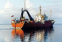
 Farnella |
Chezar, H., and Newman, I., 2006, Overview: DVD-video disc set of seafloor transects during USGS research cruises in the Pacific Ocean: U.S. Geological Survey Open-File Report 2004-1101, https://pubs.usgs.gov/of/2004/1101/.
Chezar, H., and Newman, Ivy, 2004, DVD-Video Disc set of seafloor transects during USGS research cruises in the Pacific Ocean: U.S. Geological Survey Open-File Report 2004-1137.
FAN F491CP has data viewable in the CMGP Video and Photograph Portal. View the data in this application here. See the instructions for working with this application.