AKA: none
Other ID: F-5-92-SC
Status: Completed
Organization(s):
Funding Program(s):
Principal Investigator(s): Brian Edwards, Homa Lee
Affiliate Investigator(s):
Information Specialist(s):
Data Type(s): Imagery: Photo, Location-Elevation: Navigation, Sampling: Biology, Sampling: Geology, Seismics: Sub Bottom Profiler, Sonar: Single Beam
Scientific Purpose/Goals:
Vehicle(s):
Start Port/Location:
End Port/Location:
Start Date: 1992-06-30
End Date: 1992-07-14
Equipment Used: 3.5khz, underwatercamera, boxcore, gravitycore, GPS, miniranger, 10khz
Information to be Derived:
Summary of Activity and Data Gathered:
Staff: John Barber, Wendy Bryant, John Chin, Tisha Clark, Robert Eganhouse, Jon Erickson, Grace Fong, Greg Gabel, Gerry Hatcher, Eran Hayden, Robert Kayen, Kaye Kinoshita, William McArthur, Ledabeth Pickthorn, Jim Vaughan, Steve Wessels
Affiliate Staff:
John Nichols - Ship Captain
Terry Chantler - Chief Mate
Lee Hussey - Chief Engineer
Dave Mason (USGS Western Region
amg) - Mechanical Technician
Rob Westcroft (WHOI) - Geologist
Jay Sisson (WHOI) - Geologist
Eric Bradley (WHOI) - Geologist
Karla Ebert (CH2M
Hill) - Unspecified Investigator
Carol Schechtman (CH2M
Hill) - Unspecified Investigator
Robbie Hedeen (EPA) - Unspecified Investigator
Stewart Simpson (EPA) - Unspecified Investigator
Robbie Hedeen (EPA) - Unspecified Investigator
Notes: Palos Verdes Sampling
Staff information imported from InfoBank
John Nichols - Ship Captain
Terry Chantler - Chief Mate
Lee Hussey - Chief Engineer
Homa Lee (USGS Western Region) - Chief Scientist
Brian Edwards (USGS Western Region) - Chief Scientist
Gerry Hatcher (URI) - Computer Analyst
Jon Erickson (USGS Western Region) - Mechanical Technician
Dave Mason (USGS Western Region, amg) - Mechanical Technician
Jim Vaughan (USGS Western Region) - Electronics Technician
Wendy Bryant (USGS WRD Reston) - Chemist
My (Chemist, USGS WRD Reston) - Chau Tran
Bob Eganhouse (USGS WRD Reston) - Geochemist
Rob Westcroft (WHOI) - Geologist
Jay Sisson (WHOI) - Geologist
Eric Bradley (WHOI) - Geologist
Grace Fong (USGS Western Region) - Navigator
Kaye Kinoshita (USGS Western Region) - Navigator
John Chin (USGS Western Region) - Geologist
Tisha Clark (USGS Western Region) - Geologist
John Barber (USGS Western Region) - Geologist
David Thompson (USGS Western Region) - Geologist
Eran Hayden (USGS Western Region) - Geologist
Willie McArthur (USGS Western Region) - Geologist
Greg Gabel (USGS Western Region) - Geologist
Rob Kayen (USGS Western Region) - Unspecified Investigator
Karla Ebert (CH2M, Hill) - Unspecified Investigator
Carol Schechtman (CH2M, Hill) - Unspecified Investigator
Robbie Hedeen (EPA) - Unspecified Investigator
Stewart Simpson (EPA) - Unspecified Investigator
Steve Wessels (USGS Western Region) - Photographer
Ledabeth Pickthorn (USGS Western Region, listed as Ledabeth Gray) - Navigator
Grace Fong (USGS Western Region) - Navigator
Robbie Hedeen (EPA) - Unspecified Investigator
Location:
Southern California
| Boundaries | |||
|---|---|---|---|
| North: 37.83569 | South: 33.53372 | West: -122.684 | East: -118.21603 |
Platform(s):
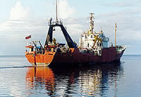
 Farnella |
Lee, H.J., Drake, D.E., Edwards, B.D., Hamer, M.R., Hampton, M.A., Karl, H.A., Kayen, R.E., and Wong, F.L., 1995, Mapping the distribution and character of contaminated sediment on the continental margin near Los Angeles, California, in Linked Earth systems: congress program and abstracts; v. 1: Tulsa, OK, Society of Economic Paleontologists and Mineralogists.
Lee, H.J., Drake, D.E., Edwards, B.D., Hamer, M.R., Hampton, M.A., Karl, H.A., Kayen, R.E., Wong, F.L., and Murray, C.J., 1996, Contaminated, Effluent-Affected Sediment on the Continental Margin near Los Angeles, California: EOS Trans. AGU, 76(3), Ocean Sciences Meeting Supplement OS1, 1996.
Reid, J.A., Reid, J.M., Jenkins, C.J., Zimmermann, M., Williams, S.J., and Field, M.E., 2006, usSEABED: Pacific coast (California, Oregon, Washington) offshore surficial-sediment data release: U.S. Geological Survey Data Series 182, http://pubs.usgs.gov/ds/2006/182/.
Wong, F.L., 1996, Heavy Mineralogy of Effluent-Affected Sediment, Palos Verdes, Southern California: EOS Transactions, v. 77 no. 3, pp. 50–50.
| Survey Equipment | Survey Info | Data Type(s) | Data Collected |
|---|---|---|---|
| 3.5khz | --- | Sub Bottom Profiler | Survey information |
| underwatercamera | --- | Video Photo | Station Information |
| boxcore | --- | Biology Geology | Station Information |
| gravitycore | --- | Geology | f-5-92-sc.171B1_search.pdf Station Information |
| GPS | --- | Navigation | Best file with nav in ArcInfo E00 format Global positioning system (GPS) data f-5-92-sc.060 (Provisional best file) Global positioning system (GPS) data f-5-92-sc.060_degree Global positioning system (GPS) data f-5-92-sc.060cp |
| miniranger | --- | Navigation | Miniranger Land Table in Lat/Long f-5-92-sc.640 |
| 10khz | --- | Single Beam | Survey information |