AKA: none
Other ID: F-6-88-HW
Status: Completed
Organization(s):
Funding Program(s): Geological Long-Range Inclined Asdic (GLORIA) (MU116)
Principal Investigator(s): Mark Holmes
Affiliate Investigator(s): Roger Denlinger
Information Specialist(s):
Data Type(s): Electro-Magnetic: Gravity, Electro-Magnetic: Magnetics, Environmental Data: Conductivity, Environmental Data: Temperature, Location-Elevation: Navigation, Seismics: Multichannel, Seismics: Sub Bottom Profiler, Sonar: Sidescan, Sonar: Single Beam
Scientific Purpose/Goals:
Vehicle(s):
Start Port/Location: Honolulu, Hawaii
End Port/Location: Honolulu, Hawaii
Start Date: 1988-05-04
End Date: 1988-05-26
Equipment Used: 10khz, 2channelairgun, Gloriasidescan, magnetics, gravity, expendablebatthermograph, GPS, integratednavigation, RhoRho, 3.5khz
Information to be Derived:
Summary of Activity and Data Gathered:
Staff: Kai Eder
Affiliate Staff:
Notes: Associated cruises: F-5-86-HW F-6-86-HW F-3-88-HW F-4-88-HW F-5-88-HW F-6-88-HW F-10-88-HW F-12-89-HW F-13-89-HW F-1-90-HW F-2-90-HW F-6-91-CP F-10-91-HW Geological LOng-Range Inclined Asdic (GLORIA) GLORIA
Staff information imported from InfoBank
Mark Holmes - Chief Scientist
Roger Denlinger - Chief Scientist
12/7/2004 email from Shawn Dadisman:
I noticed there was very little info on this cruise and that I didn't show up as crew. So here's what I can remember. Kaye [Kinoshita] did DAFE and Doug Rearic and I were watch standers. Both ports were Honolulu. The only IOS guy I can remember is Mick Gooden. If you need that info I have photos of the cruise at home and can look them up.
Location:
Hawaii
| Boundaries | |||
|---|---|---|---|
| North: 26.2283 | South: 20.94708 | West: -162.646 | East: -157.0976 |
Platform(s):
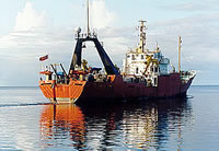
 Farnella |
Kayen, R.E., Torresan, M.E., Dadisman, S.V., Clague, D.A., Drake, D.E., Gutmacher, C.E., Hampton, M.A., Marlow, M.S., Moore, J.G., Normark, W.R., Pickthorn, L.G., Shor, S., Denlinger, R.P., Holcomb, R.T., Holmes, M.L., Lipman, P.W., Belderson, R.H., Jacobs, C., Searle, R.C., Wilson, J.B., and Rothwell, R.G., 1990, GLORIA side-scan sonar imagery of the Hawaiian Islands exclusive economic zone: American Geophysical Union Eos, Transactions, v. 71 no. 43, pp. 1580–1580.
Moore, J.G., and Normark, W.R.,, 1990, Significance of major landslides on the Hawaiian Ridge: American Association of Petroleum Geologists Bulletin, v. 74 no. 6, pp. 991–992.
Paskevich, V.F., Wong, F.L., O'Malley, J.J., Stevenson, A.J., and Gutmacher, C.E., 2011, GLORIA sidescan-sonar imagery for parts of the U.S. Exclusive Economic Zone and adjacent areas: U.S. Geological Survey Open-File Report 2010-1332, http://pubs.usgs.gov/of/2010/1332/.