AKA: none
Other ID: F-7-87-SC
Status: Completed
Organization(s):
Funding Program(s):
Principal Investigator(s): James Hein
Affiliate Investigator(s):
Information Specialist(s):
Data Type(s): Imagery: Photo, Location-Elevation: Navigation, Sampling: Geology, Seismics: Air Gun / Water Gun, Seismics: Sub Bottom Profiler, Sonar: Single Beam
Scientific Purpose/Goals:
Vehicle(s):
Start Port/Location: RC
End Port/Location: ?
Start Date: 1987-12-03
End Date: 1987-12-21
Equipment Used: RhoRho, GPS, 3.5khz, 10khz, chaindredge, watergun, underwatercamera, airgun
Information to be Derived:
Summary of Activity and Data Gathered: physical data holdings
Staff:
Affiliate Staff:
Notes: Staff information imported from InfoBank
Jim Hein (USGS Western Region) - Chief Scientist
Location:
Southern California
| Boundaries | |||
|---|---|---|---|
| North: 34.38285 | South: 30.11733 | West: -123.3922 | East: -120.02333 |
Platform(s):
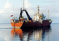
 Farnella |
Adamczyk, K., Mizell, K., Payan, D., Dominguez, N.O., Oliva, L., and Gartman, A., 2023, Marine mineral geochemical data - Part One: Pacific Ocean USGS-affiliated historical data: U.S. Geological Survey data release, https://doi.org/10.5066/P9GD1JKB.
Chezar, H., and Newman, I., 2006, Overview: DVD-video disc set of seafloor transects during USGS research cruises in the Pacific Ocean: U.S. Geological Survey Open-File Report 2004-1101, https://pubs.usgs.gov/of/2004/1101/.
Chezar, H., and Newman, Ivy, 2004, DVD-Video Disc set of seafloor transects during USGS research cruises in the Pacific Ocean: U.S. Geological Survey Open-File Report 2004-1141.
Chezar, H., and Newman, Ivy, 2004, DVD-Video Disc set of seafloor transects during USGS research cruises in the Pacific Ocean: U.S. Geological Survey Open-File Report 2004-1142.
Chezar, H., and Newman, Ivy, 2004, DVD-Video Disc set of seafloor transects during USGS research cruises in the Pacific Ocean: U.S. Geological Survey Open-File Report 2004-1143.
Davis, A.S., Clague, D.A., Friesen, W.B., and Hein, J.R., 1989, Composition of basaltic glasses dredged from seven seamounts offshore Southern California on R/V Farnella Cruise F7-87-SC: U.S. Geological Survey Open-File Report 90-0053, 21 p.
Davis, A.S., Gunn, S.H., Bohrson, W.A., Gray, L.-B., and Hein, J.R., 1995, Chemically diverse, sporadic volcanism at seamounts offshore Southern and Baja California: Geological Society of America Bulletin, v. 107 no. 5, pp. 554–570.
Hein, J.R., Koschinsky, A., Halbach, P.E., Manheim, F.T., Bau, M., Kang, J.-K., and Lubick, N., 1997, Iron and manganese oxide mineralization in the Pacific, in Nicholson, Keith, Hein, James R., Buehn, Bernhard, and Dasgupta, Somnath, eds., Manganese mineralization; geochemistry and mineralogy of terrestrial and marine deposits: Geological Society Special Publications, v. 119, pp. 123–138.
von Blanckenburg, F., Belshaw, N.S., O'Nions, R.K., and Hein, J.R., 1995, Study of beryllium isotopes in oceanic deep-water circulation from Recent ferromanganese crusts, in Global change and marine geology: 85; Jahrestagung der Geologischen Vereinigung e.V.; Zusammenfassung der Tagungsbeitraege: Bonn, Terra Nostra, v. 1-95, pp. 5–5.
von Blanckenburg, F., O'Nions, R.K., Belshaw, N.S., Gibb, A., and Hein, J.R., 1996, Global distribution of beryllium isotopes in deep ocean water as derived from Fe-Mn crusts: Earth and Planetary Science Letters, v. 141 no. 1-4, pp. 213–226.
von Blanckenburg, F.V., Belshaw, N., O'Nions, R.K., and Hein, J., 1993, Use of (super 10) Be/ (super 9) Be as a water mass tracer; variations in Atlantic and Pacific seawater: American Geophysical Union Eos, Transactions, v. 74 no. 43, pp. 367–367.
von Blanckenburg, F., O'Nions, R.K., and Hein, J.R., 1996, Distribution and sources of pre-anthropogenic lead isotopes in deep ocean water from Fe-Mn crusts: Geochimica et Cosmochimica Acta, v. 60 no. 24, pp. 4957–4963.
FAN F787SC has data viewable in the CMGP Video and Photograph Portal. View the data in this application here. See the instructions for working with this application.