AKA: none
Other ID: F-7-90-NC,FRNLF7-90-NC
Status: Completed
Organization(s): USGS, Pacific Coastal and Marine Science Center
Funding Program(s):
Principal Investigator(s): Herman Karl, Dave Drake
Affiliate Investigator(s): Bill Schwab (USGS Woods Hole)
Information Specialist(s):
Data Type(s): Location-Elevation: Navigation, Location-Elevation: Transects, Seismics: Sub Bottom Profiler, Sonar: Single Beam, Sonar: Sidescan
Scientific Purpose/Goals:
Vehicle(s):
Start Port/Location: Redwood City, CA
End Port/Location: Redwood City, CA
Start Date: 1990-07-19
End Date: 1990-08-03
Equipment Used: integratednavigation, rangerange, GPS, RhoRho, bottomtransponder, 3.5khz, 4dot5khz, 10khz, sidescansonar
Information to be Derived:
Summary of Activity and Data Gathered:
Staff: Bill Danforth, Barry Irwin, John Chin, Doug Musser, Kaye Kinoshita, Ledabeth Pickthorn, Warren Scherfius, Steve Wessels, Larry Kooker
Affiliate Staff:
John Cannan (J. Marr and Sons) - Captain
Tom O'Brien (USGS Woods Hole) - Geophysicist
Tom Crook (WHOI
DSL) - Navigator
Kevin Redman (IDSS) - Unsp. Inv.
Alan Ota (EPA) - Unsp. Inv.
Kirk O'Donnell (IDSS) - Unsp. Inv.
Tom Dettweiler (Meridan) - Unsp. Inv.
Chester Alysta (IDSS) - Unsp. Inv.
Dave Wyatt (Meridan) - Unsp. Inv.
Ski Laniewicz (IDSS) - Unsp. Inv.
Art Wright (IDSS) - Unsp. Inv.
Matthew Gilbey (J. Marr) - Chief Engineer
Albert Fuller (J. Marr) - Chief Mate
Notes: EPA Gulf of the Farallones
Staff information imported from InfoBank
Herman Karl (USGS Western Region) - Chief Scientist
Dave Drake (USGS Western Region) - Chief Scientist
Bill Schwab (USGS Woods Hole) - Chief Scientist
John Cannan (J. Marr and Sons) - Captain
Bill Danforth (USGS Woods Hole) - Geologist
Barry Irwin (USGS Woods Hole) - Navigator
Tom O'Brien (USGS Woods Hole) - Geophysicist
John Chin (USGS Western Region) - Geologist
Doug Musser (USGS Western Region) - Navigator
Kaye Kinoshita (USGS Western Region) - Navigator
Tom Crook (WHOI, DSL) - Navigator
Ledabeth Pickthorn (USGS Western Region) - Navigator
Warren Scherfius (USGS Western Region) - Photographer
Steve Wessels (USGS Western Region) - Photographer
Larry Kooker (USGS Western Region) - Electronics
Kevin Redman (IDSS) - Unsp. Inv.
Alan Ota (EPA) - Unsp. Inv.
Kirk O'Donnell (IDSS) - Unsp. Inv.
Tom Dettweiler (Meridan) - Unsp. Inv.
Chester Alysta (IDSS) - Unsp. Inv.
Dave Wyatt (Meridan) - Unsp. Inv.
Ski Laniewicz (IDSS) - Unsp. Inv.
Art Wright (IDSS) - Unsp. Inv.
Matthew Gilbey (J. Marr) - Chief Engineer
Albert Fuller (J. Marr) - Chief Mate
Location:
Northern California
| Boundaries | |||
|---|---|---|---|
| North: 37.83449 | South: 37.10913 | West: -123.6317 | East: -122.19323 |
Platform(s):
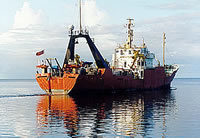
 Farnella |
Karl, H.A., Drake, D.E., Schwab, W.C., Edwards, B.D., Lee, H.J., and Chin, J.L., 1990, Progress Report on Status of Analysis and Interpretation of Data Collected on Cruises F-7-90-NC and F-8-90-NC Farallon Escarpment, 19 July to 3 August and 5 to 17 August, 1990: U. S. Geological Survey , Reston, VA http://cotuit.er.usgs.gov/Data/1990-018-FA/NL/001/01/90018rpt.pdf.
Schreppel, H.A., Degnan, C.H, Dadisman, S.V., and Metzger, D.R., 2013, Archive of U.S. Geological Survey Selected Single-Beam Bathymetry Datasets, 1969â2000: U.S. Geological Survey Data Series 757, http://pubs.usgs.gov/ds/757/.
| Survey Equipment | Survey Info | Data Type(s) | Data Collected |
|---|---|---|---|
| integratednavigation | --- | Navigation | Integrated navigation (SINS) data f-7-90-nc.052_degree Survey information Lines Best file with nav in ArcInfo E00 format Integrated navigation (SINS) data f-7-90-nc.052 (Provisional best file) |
| rangerange | --- | Navigation | Raw Del Norte data f-7-90-nc.672 Survey information |
| GPS | --- | Navigation | Global positioning system (GPS) data f-7-90-nc.061 Survey information |
| RhoRho | --- | Navigation | Survey information Loran C data f-7-90-nc.030-_hyp Loran C data f-7-90-nc.030-_rho |
| bottomtransponder | --- | Transects | Survey information |
| 3.5khz | --- | Sub Bottom Profiler | Survey information |
| 4dot5khz | --- | Sub Bottom Profiler | Survey information |
| 10khz | --- | Single Beam | Raw depth (bathymetry) data f-7-90-nc.300 Survey information NGDC MGD77 data - bathy Raw depth (bathymetry) data f-7-90-nc.300_052 (Provisional best file) |
| sidescansonar | --- | Sidescan | Survey information File list |