AKA: none
Other ID: F-9-89-NC,FRNLF9-89-NC
Status: Completed
Organization(s): USGS, Pacific Coastal and Marine Science Center
Funding Program(s):
Principal Investigator(s): John Chin, Herman Karl
Affiliate Investigator(s): Bill Schwab (USGS Woods Hole)
Information Specialist(s):
Data Type(s): Seismics: Sub Bottom Profiler, Sonar: Single Beam, Sonar: Sidescan, Electro-Magnetic: Gravity, Location-Elevation: Navigation
Scientific Purpose/Goals:
Vehicle(s):
Start Port/Location: Redwood City, CA and Drakes Bay, CA
End Port/Location: Drakes Bay, CA Pick up D and Redwood City, CA
Start Date: 1989-08-02
End Date: 1989-08-18
Equipment Used: 3.5khz, 10khz, sidescansonar, gravity, rangerange, GPS, integratednavigation, RhoRho, Sonatracktransducer
Information to be Derived:
Summary of Activity and Data Gathered:
Staff: Robin Bouse, Bill Danforth, Jana DaSilva, Michael Hamer, Kaye Kinoshita, Larry Kooker, Michael Torresan, Hal Williams, Bob Elder, Tom Bettweiler
Affiliate Staff:
John Cannan (J. Marr and Sons) - Captain
Tom O'Brien (USGS Woods Hole) - Unspecified
Notes:
Staff information imported from InfoBank
John Chin (USGS Western Region) - Chief Scientist
Herman Karl (USGS Western Region) - Chief Scientist
Bill Schwab (USGS Woods Hole) - Chief Scientist
John Cannan (J. Marr and Sons) - Captain
Robin Bouse (USGS Woods Hole) - Unspecified
Bill Danforth (USGS Woods Hole) - Unspecified
Jana DaSilva (USGS Woods Hole) - Unspecified
Tom O'Brien (USGS Woods Hole) - Unspecified
Michael Hamer (USGS Western Region) - Unspecified
Kaye Kinoshita (USGS Western Region) - Unspecified
Larry Kooker (USGS Western Region) - Unspecified
Mike Torresan (USGS Western Region) - Unspecified
Hal Williams (USGS Western Region) - Unspecified
Bob Elder (DSL, WHOI) - Unspecified
Tom Bettweiler (Meridian Sciences) - Unspecified
Location:
Northern California
| Boundaries | |||
|---|---|---|---|
| North: 38.00289 | South: 37.50707 | West: -123.3872 | East: -122.19342 |
Platform(s):
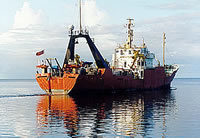
 Farnella |
Sweeney, E.M., Danforth, W.W., Karl, H.A., O'Brien, T.F., and Schwab, W.C., 2004, The Gulf of the Farallones - Sidescan-Sonar Imagery: U.S. Geological Survey Open-File Report 2004-1082, https://pubs.usgs.gov/of/2004/1082/.