AKA: none
Other ID: F-E3-09-MB,SCH_FE
Status: Completed
Organization(s): USGS, Pacific Coastal and Marine Science Center
Funding Program(s): National Seafloor Mapping and Benthic Mapping Studies (MU196), Santa Cruz Harbor Demonstration Project (MU253)
Principal Investigator(s): Christopher Conaway, Curt Storlazzi
Affiliate Investigator(s):
Information Specialist(s): Joshua Logan
Data Type(s): Imagery: Photo, Location-Elevation: Navigation
Scientific Purpose/Goals: To determine sea floor sediment grain size variability in the study area.
Vehicle(s):
Start Port/Location: Santa Cruz Harbor
End Port/Location: Santa Cruz Harbor
Start Date: 2009-10-29
End Date: 2009-10-29
Equipment Used: Eyeball, GPS
Information to be Derived:
Summary of Activity and Data Gathered:
Staff: Henry Chezar, Peter Dal Ferro, Joshua Logan, Curt Storlazzi
Affiliate Staff:
Notes: Staff information imported from InfoBank
Curt Storlazzi (USGS, PSC) - chief scientist
Christopher Conaway (chief scientist, USGS, PSC) - co
Josh Logan (geographer, USGS, PSC) - vessel captain
Pete Dal Ferro (mechanical technician, USGS, MARFAC) - vessel captain
Hank Chezar (USGS, MARFAC) - photographic technician
Location:
Monterey Bay
| Boundaries | |||
|---|---|---|---|
| North: 36.96151 | South: 36.92396 | West: -122.022 | East: -121.99311 |
Platform(s):
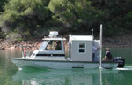 Frontier |
| Survey Equipment | Survey Info | Data Type(s) | Data Collected |
|---|---|---|---|
| Eyeball | --- | Photo | Station Information |
| GPS | --- | Navigation | Best file with nav in ArcInfo E00 format Global positioning system (GPS) data f-e3-09- (Provisional best file) |
